Area Overview for NG24 2NP
Photos of NG24 2NP
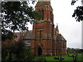
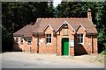
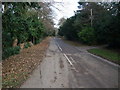
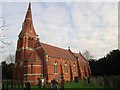
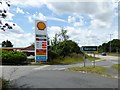
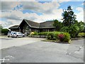
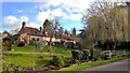
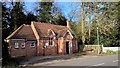
69 photos from this area
Area Information
Key information about the NG24 2NP including its size, population, and administrative classification.
- Area Type
- Postcode
- Area Size
- 16.9 hectares
- Population
- 2733
- Population Density
- 87 people/km²
House Prices in NG24 2NP
23
Properties
£330,700
Average Sold Price
£257,000
Lowest Price
£418,100
Highest Price
Showing 23 properties
| Address | Type | Beds | Baths | Last Sale Price | Last Sale Date | |
|---|---|---|---|---|---|---|
| West Riding, Hargon Lane, Winthorpe, NG24 2NP | Bungalow | 3 | 1 | £317,000 | Jan 2025 | |
| Hargon House, Hargon Lane, Winthorpe, NG24 2NP | Bungalow | 3 | - | £418,100 | Jul 2021 | |
| Little Orchard, Hargon Lane, Winthorpe, NG24 2NP | Bungalow | 3 | 2 | £257,000 | Jun 2005 | |
| 19 Hargon Lane, Winthorpe, NG24 2NP | Detached | 3 | 1 | - | - | |
| 7 Hargon Lane, Winthorpe, NG24 2NP | Detached | 2 | 1 | - | - | |
| 5 Hargon Lane, Winthorpe, NG24 2NP | Bungalow | 2 | 2 | - | - | |
| Meadow View, 13 Hargon Lane, Winthorpe, NG24 2NP | Bungalow | 2 | 1 | - | - | |
| 25 Hargon Lane, Winthorpe, NG24 2NP | Bungalow | 3 | 2 | - | - | |
| 27 Hargon Lane, Winthorpe, NG24 2NP | Bungalow | 3 | 1 | - | - | |
| Brae Barn, Hargon Lane, Winthorpe, NG24 2NP | Bungalow | 3 | 1 | - | - |
Page 1 of 3
Energy Efficiency in NG24 2NP
Amenities
Schools
| Rank | School | Type | Entry gender | Ages |
|---|
Explore more schools in this area
Go to Schools tabDemographics
Household Size
Two person
most common
Accommodation Type
Houses
most common
Tenure
82
majority
Ethnic Group
White
most common
Religion
N/A
most common
Household Composition
N/A
most common
Age
47
median
Adults (30-64 years)
most common
Household Deprivation
N/A
with no deprivation
NS-SEC
39
in Lower managerial occupations
Explore more demographic insights in this area
Go to Demographics tabPlanning
Planning Constraints
- Flood RiskPremium
- Ramsar Wetland SitesPremium
- Area of Outstanding Natural BeautyPremium
- Protected Nature ReservePremium
- Protected WoodlandPremium