Area Overview for NG24 1SJ
Photos of NG24 1SJ
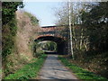
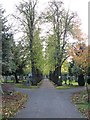
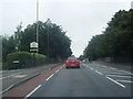
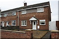

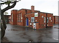

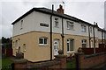
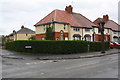
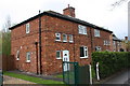
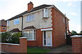
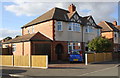
78 photos from this area
Area Information
Key information about the NG24 1SJ including its size, population, and administrative classification.
- Area Type
- Postcode
- Area Size
- 1.6 hectares
- Population
- 1475
- Population Density
- 2850 people/km²
House Prices in NG24 1SJ
27
Properties
£184,996
Average Sold Price
£59,000
Lowest Price
£315,000
Highest Price
Showing 27 properties
| Address | Type | Beds | Baths | Last Sale Price | Last Sale Date | |
|---|---|---|---|---|---|---|
| 13 Bancroft Road, Newark On Trent, NG24 1SJ | Semi-detached | 3 | 1 | £237,500 | Jun 2024 | |
| 31 Bancroft Road, Newark On Trent, NG24 1SJ | Semi-detached | 3 | 1 | £212,500 | Feb 2024 | |
| 18 Bancroft Road, Newark On Trent, NG24 1SJ | Semi-detached | 5 | 2 | £315,000 | Dec 2022 | |
| 11 Bancroft Road, Newark On Trent, NG24 1SJ | house | - | - | £198,500 | Sep 2021 | |
| 12 Bancroft Road, Newark On Trent, NG24 1SJ | house | - | - | £260,000 | Dec 2020 | |
| 16 Bancroft Road, Newark On Trent, NG24 1SJ | Semi-detached | 3 | 1 | £166,000 | Aug 2020 | |
| 23 Bancroft Road, Newark On Trent, NG24 1SJ | house | - | - | £152,000 | May 2016 | |
| 19 Bancroft Road, Newark On Trent, NG24 1SJ | house | - | - | £209,000 | Mar 2016 | |
| 20 Bancroft Road, Newark On Trent, NG24 1SJ | Semi-detached | 3 | - | £177,950 | Jun 2015 | |
| 14 Bancroft Road, Newark On Trent, NG24 1SJ | Semi-detached | 4 | 2 | £179,500 | Mar 2014 |
Page 1 of 3
Energy Efficiency in NG24 1SJ
Amenities
Schools
| Rank | School | Type | Entry gender | Ages |
|---|
Explore more schools in this area
Go to Schools tabDemographics
Household Size
Two person
most common
Accommodation Type
Houses
most common
Tenure
69
majority
Ethnic Group
White
most common
Religion
N/A
most common
Household Composition
N/A
most common
Age
47
median
Adults (30-64 years)
most common
Household Deprivation
N/A
with no deprivation
NS-SEC
33
in Lower managerial occupations
Explore more demographic insights in this area
Go to Demographics tabPlanning
Planning Constraints
- Flood RiskPremium
- Ramsar Wetland SitesPremium
- Area of Outstanding Natural BeautyPremium
- Protected Nature ReservePremium
- Protected WoodlandPremium