Area Overview for NG24 1FS
Photos of NG24 1FS

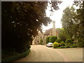
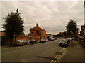

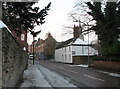
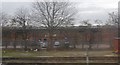


100 photos from this area
Area Information
Key information about the NG24 1FS including its size, population, and administrative classification.
- Area Type
- Postcode
- Area Size
- 14.1 hectares
- Population
- 2190
- Population Density
- 1192 people/km²
House Prices in NG24 1FS
56
Properties
£124,210
Average Sold Price
£103,000
Lowest Price
£149,950
Highest Price
Showing 56 properties
| Address | Type | Beds | Baths | Last Sale Price | Last Sale Date | |
|---|---|---|---|---|---|---|
| 10, Waters Edge, Kings Sconce Avenue, Newark On Trent, NG24 1FS | Detached | 2 | 1 | £143,000 | Sep 2021 | |
| 17, Waters Edge, Kings Sconce Avenue, Newark On Trent, NG24 1FS | house | - | - | £149,950 | Aug 2021 | |
| 20, Waters Edge, Kings Sconce Avenue, Newark On Trent, NG24 1FS | Detached | 2 | 1 | £138,000 | Feb 2021 | |
| 12, Waters Edge, Kings Sconce Avenue, Newark On Trent, NG24 1FS | Semi-detached | 2 | 1 | £130,000 | Apr 2020 | |
| 15, Waters Edge, Kings Sconce Avenue, Newark On Trent, NG24 1FS | Semi-detached | 2 | 1 | £130,000 | Dec 2019 | |
| 26, Waters Edge, Kings Sconce Avenue, Newark On Trent, NG24 1FS | house | - | - | £128,000 | Oct 2019 | |
| 21, Waters Edge, Kings Sconce Avenue, Newark On Trent, NG24 1FS | Semi-detached | 2 | 1 | £126,000 | Oct 2019 | |
| 23, Waters Edge, Kings Sconce Avenue, Newark On Trent, NG24 1FS | Semi-detached | 2 | 1 | £119,000 | Sep 2019 | |
| 16, Waters Edge, Kings Sconce Avenue, Newark On Trent, NG24 1FS | Semi-detached | 2 | 1 | £140,000 | Mar 2018 | |
| 24, Waters Edge, Kings Sconce Avenue, Newark On Trent, NG24 1FS | Terraced | 2 | 1 | £105,000 | Jun 2014 |
Page 1 of 6
Energy Efficiency in NG24 1FS
Amenities
Schools
| Rank | School | Type | Entry gender | Ages |
|---|
Explore more schools in this area
Go to Schools tabDemographics
Household Size
One person
most common
Accommodation Type
Houses
most common
Tenure
36
majority
Ethnic Group
White
most common
Religion
N/A
most common
Household Composition
N/A
most common
Age
47
median
Adults (30-64 years)
most common
Household Deprivation
N/A
with no deprivation
NS-SEC
25
in Lower managerial occupations
Explore more demographic insights in this area
Go to Demographics tabPlanning
Planning Constraints
- Flood RiskPremium
- Ramsar Wetland SitesPremium
- Area of Outstanding Natural BeautyPremium
- Protected Nature ReservePremium
- Protected WoodlandPremium