Area Overview for NG23 7HX
Photos of NG23 7HX
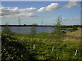
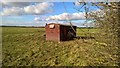
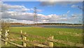

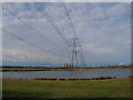

23 photos from this area
Area Information
Key information about the NG23 7HX including its size, population, and administrative classification.
- Area Type
- Postcode
- Area Size
- 3.7 km²
- Population
- 1616
- Population Density
- 37 people/km²
House Prices in NG23 7HX
20
Properties
£348,333
Average Sold Price
£250,000
Lowest Price
£600,000
Highest Price
Showing 20 properties
| Address | Type | Beds | Baths | Last Sale Price | Last Sale Date | |
|---|---|---|---|---|---|---|
| Bracken Bank, Gainsborough Road, Girton, NG23 7HX | Bungalow | 3 | - | £600,000 | Feb 2021 | |
| Ashcroft, Gainsborough Road, Girton, NG23 7HX | Detached | 4 | 3 | £405,000 | Nov 2019 | |
| Glen Holt, Gainsborough Road, Girton, NG23 7HX | Detached | 5 | 3 | £295,000 | Nov 2018 | |
| Baxter Bridge Farm, Gainsborough Road, Girton, Newark, NG23 7HX | Detached | - | - | £250,000 | Dec 2016 | |
| Grange Farm, Gainsborough Road, Girton, NG23 7HX | house | - | - | £250,000 | Feb 2005 | |
| Boundary House, Gainsborough Road, Girton, NG23 7HX | Detached | - | - | £290,000 | Jun 2003 | |
| Highfield Farm, Gainsborough Road, Girton, NG23 7HX | Retail | 3 | 1 | - | - | |
| The Coach House, Gainsborough Road, Girton, NG23 7HX | Detached | 6 | 3 | - | - | |
| Holly House Farm, Gainsborough Road, Girton, Newark, NG23 7HX | Land | - | - | - | - | |
| 1, Tomkins Farm, Gainsborough Road, Girton, NG23 7HX | Equestrian | 5 | 2 | - | - |
Page 1 of 2
Energy Efficiency in NG23 7HX
Amenities
Schools
| Rank | School | Type | Entry gender | Ages |
|---|
Explore more schools in this area
Go to Schools tabDemographics
Household Size
Two person
most common
Accommodation Type
Houses
most common
Tenure
84
majority
Ethnic Group
White
most common
Religion
N/A
most common
Household Composition
N/A
most common
Age
47
median
Adults (30-64 years)
most common
Household Deprivation
N/A
with no deprivation
NS-SEC
40
in Lower managerial occupations
Explore more demographic insights in this area
Go to Demographics tabPlanning
Planning Constraints
- Flood RiskPremium
- Ramsar Wetland SitesPremium
- Area of Outstanding Natural BeautyPremium
- Protected Nature ReservePremium
- Protected WoodlandPremium