Area Overview for NG23 7ER
Photos of NG23 7ER


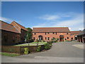
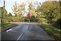
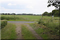
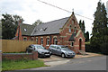
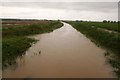
48 photos from this area
Area Information
Key information about the NG23 7ER including its size, population, and administrative classification.
- Area Type
- Postcode
- Area Size
- 1.5 km²
- Population
- 1616
- Population Density
- 37 people/km²
House Prices in NG23 7ER
33
Properties
£337,938
Average Sold Price
£115,000
Lowest Price
£575,000
Highest Price
Showing 33 properties
| Address | Type | Beds | Baths | Last Sale Price | Last Sale Date | |
|---|---|---|---|---|---|---|
| Lindrick House, Thorney Road, Wigsley, NG23 7ER | Detached | 5 | 2 | £560,000 | May 2025 | |
| Brierley Grange, Thorney Road, Wigsley, NG23 7ER | Detached | 5 | 4 | £575,000 | Jul 2023 | |
| Wendover House, Thorney Road, Wigsley, NG23 7ER | Detached | 4 | 3 | £491,000 | Nov 2022 | |
| The Chestnuts, Thorney Road, Wigsley, NG23 7ER | Bungalow | 3 | 1 | £430,000 | May 2022 | |
| Orchard House, Thorney Road, Wigsley, NG23 7ER | house | - | - | £475,000 | May 2022 | |
| Holly Bank, Thorney Road, Wigsley, NG23 7ER | Bungalow | - | - | £360,000 | Feb 2022 | |
| Cromwell Barn, Thorney Road, Wigsley, NG23 7ER | Semi-detached | 4 | - | £250,000 | Jul 2014 | |
| Woodyard House, Thorney Road, Wigsley, NG23 7ER | Detached | 3 | - | £330,000 | Jul 2014 | |
| Holly Farm, Thorney Road, Wigsley, NG23 7ER | house | - | - | £249,950 | Mar 2008 | |
| The Old Chapel, Thorney Road, Wigsley, NG23 7ER | house | 4 | - | £120,000 | Oct 2007 |
Page 1 of 4
Energy Efficiency in NG23 7ER
Amenities
Schools
| Rank | School | Type | Entry gender | Ages |
|---|
Explore more schools in this area
Go to Schools tabDemographics
Household Size
Two person
most common
Accommodation Type
Houses
most common
Tenure
84
majority
Ethnic Group
White
most common
Religion
N/A
most common
Household Composition
N/A
most common
Age
47
median
Adults (30-64 years)
most common
Household Deprivation
N/A
with no deprivation
NS-SEC
40
in Lower managerial occupations
Explore more demographic insights in this area
Go to Demographics tabPlanning
Planning Constraints
- Flood RiskPremium
- Ramsar Wetland SitesPremium
- Area of Outstanding Natural BeautyPremium
- Protected Nature ReservePremium
- Protected WoodlandPremium