Area Overview for NG23 7AQ
Photos of NG23 7AQ
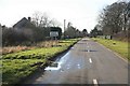
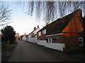
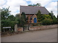
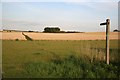
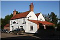
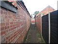
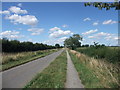
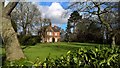
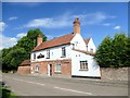
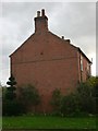
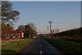
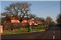
55 photos from this area
Area Information
Key information about the NG23 7AQ including its size, population, and administrative classification.
- Area Type
- Postcode
- Area Size
- 16.4 hectares
- Population
- 1616
- Population Density
- 37 people/km²
House Prices in NG23 7AQ
17
Properties
£375,125
Average Sold Price
£85,000
Lowest Price
£625,000
Highest Price
Showing 17 properties
| Address | Type | Beds | Baths | Last Sale Price | Last Sale Date | |
|---|---|---|---|---|---|---|
| Wheel Gate, Vicarage Road, South Clifton, NG23 7AQ | Detached | 4 | 2 | £450,000 | Mar 2025 | |
| Field View, Vicarage Road, South Clifton, NG23 7AQ | Bungalow | 3 | 2 | £340,000 | Mar 2025 | |
| Hillside, Vicarage Road, South Clifton, NG23 7AQ | Detached | 3 | 2 | £310,000 | Jun 2023 | |
| Clifton Barn, Vicarage Road, South Clifton, NG23 7AQ | house | - | - | £625,000 | Oct 2020 | |
| Edgefield House, Vicarage Road, South Clifton, NG23 7AQ | Detached | 4 | 3 | £385,000 | Sep 2015 | |
| Bonington, Vicarage Road, South Clifton, NG23 7AQ | Detached | - | - | £485,000 | Jul 2014 | |
| Nursery Croft, Vicarage Road, South Clifton, NG23 7AQ | house | 5 | - | £321,000 | Jun 2011 | |
| Highfield Cottage, Vicarage Road, South Clifton, NG23 7AQ | Detached | - | - | £85,000 | Apr 1997 | |
| The Cottage, Vicarage Road, South Clifton, NG23 7AQ | Cottage | 4 | 2 | - | - | |
| The Trees, Vicarage Road, South Clifton, NG23 7AQ | Bungalow | 2 | 1 | - | - |
Page 1 of 2
Energy Efficiency in NG23 7AQ
Amenities
Schools
| Rank | School | Type | Entry gender | Ages |
|---|
Explore more schools in this area
Go to Schools tabDemographics
Household Size
Two person
most common
Accommodation Type
Houses
most common
Tenure
84
majority
Ethnic Group
White
most common
Religion
N/A
most common
Household Composition
N/A
most common
Age
47
median
Adults (30-64 years)
most common
Household Deprivation
N/A
with no deprivation
NS-SEC
40
in Lower managerial occupations
Explore more demographic insights in this area
Go to Demographics tabPlanning
Planning Constraints
- Flood RiskPremium
- Ramsar Wetland SitesPremium
- Area of Outstanding Natural BeautyPremium
- Protected Nature ReservePremium
- Protected WoodlandPremium