Area Overview for NG22 9PN
Photos of NG22 9PN
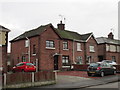
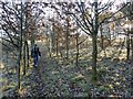
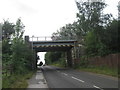
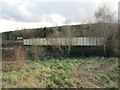
30 photos from this area
Area Information
Key information about the NG22 9PN including its size, population, and administrative classification.
- Area Type
- Postcode
- Area Size
- 3.2 hectares
- Population
- 1298
- Population Density
- 1729 people/km²
House Prices in NG22 9PN
37
Properties
£108,286
Average Sold Price
£27,000
Lowest Price
£165,000
Highest Price
Showing 37 properties
| Address | Type | Beds | Baths | Last Sale Price | Last Sale Date | |
|---|---|---|---|---|---|---|
| 3 Rufford Avenue, Ollerton, NG22 9PN | Semi-detached | 3 | 1 | £130,000 | Jul 2022 | |
| Cleckers, 22 Rufford Avenue, Ollerton, NG22 9PN | house | - | - | £130,000 | Dec 2020 | |
| Kathisma, 5A Rufford Avenue, Ollerton, NG22 9PN | Semi-detached | 4 | 1 | £145,000 | Jan 2020 | |
| 13 Rufford Avenue, Ollerton, NG22 9PN | Detached | 4 | 2 | £149,000 | Dec 2019 | |
| 34 Rufford Avenue, Ollerton, NG22 9PN | Semi-detached | 3 | 1 | £123,000 | Nov 2019 | |
| 28 Rufford Avenue, Ollerton, NG22 9PN | Semi-detached | 3 | - | £122,000 | Feb 2017 | |
| Methodist Manse, 20 Rufford Avenue, Ollerton, NG22 9PN | house | - | - | £165,000 | Apr 2016 | |
| 36 Rufford Avenue, Ollerton, NG22 9PN | Semi-detached | 3 | - | £75,000 | Dec 2014 | |
| 2A Rufford Avenue, Ollerton, NG22 9PN | Semi-detached | 3 | - | £70,000 | Nov 2014 | |
| 26 Rufford Avenue, Ollerton, NG22 9PN | Semi-detached | - | - | £125,000 | Jan 2011 |
Page 1 of 4
Energy Efficiency in NG22 9PN
Amenities
Schools
| Rank | School | Type | Entry gender | Ages |
|---|
Explore more schools in this area
Go to Schools tabDemographics
Household Size
One person
most common
Accommodation Type
Houses
most common
Tenure
62
majority
Ethnic Group
White
most common
Religion
N/A
most common
Household Composition
N/A
most common
Age
47
median
Adults (30-64 years)
most common
Household Deprivation
N/A
with no deprivation
NS-SEC
32
in Lower managerial occupations
Explore more demographic insights in this area
Go to Demographics tabPlanning
Planning Constraints
- Flood RiskPremium
- Ramsar Wetland SitesPremium
- Area of Outstanding Natural BeautyPremium
- Protected Nature ReservePremium
- Protected WoodlandPremium