Area Overview for NG22 9LD
Photos of NG22 9LD
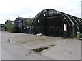

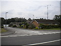
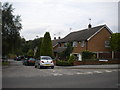
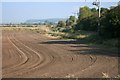
19 photos from this area
Area Information
Key information about the NG22 9LD including its size, population, and administrative classification.
- Area Type
- Postcode
- Area Size
- 24.0 hectares
- Population
- 1485
- Population Density
- 147 people/km²
House Prices in NG22 9LD
42
Properties
-
Average Sold Price
-
Lowest Price
-
Highest Price
Showing 42 properties
| Address | Type | Beds | Baths | Last Sale Price | Last Sale Date | |
|---|---|---|---|---|---|---|
| Pitstop, Boughton Industrial Estate, Boughton, NG22 9LD | storage_distribution | - | - | - | - | |
| Unit 188B, Boughton Industrial Estate, Boughton, NG22 9LD | Industrial | - | - | - | - | |
| Hanna Engineering, Unit 114B, Boughton Industrial Estate, Boughton, NG22 9LD | Industrial | - | - | - | - | |
| Key Electrical Solutions Ltd, Unit 218, Boughton Industrial Estate, Boughton, NG22 9LD | Office | - | - | - | - | |
| Gourmet Classics, Unit 204, Boughton Industrial Estate, Boughton, NG22 9LD | Industrial | - | - | - | - | |
| Offices Adjacent, Unit 180, Boughton Industrial Estate, Boughton, NG22 9LD | Office | - | - | - | - | |
| Unit 86A, Boughton Industrial Estate, Boughton, NG22 9LD | Industrial | - | - | - | - | |
| Unit 94A, Roadtrain, Boughton Industrial Estate, Boughton, NG22 9LD | Industrial | - | - | - | - | |
| Unit 113A, Boughton Industrial Estate, Boughton, NG22 9LD | Industrial | - | - | - | - | |
| Unit 111, Boughton Industrial Estate, Boughton, NG22 9LD | Industrial | - | - | - | - |
Page 1 of 5
Energy Efficiency in NG22 9LD
Amenities
Schools
| Rank | School | Type | Entry gender | Ages |
|---|
Explore more schools in this area
Go to Schools tabDemographics
Household Size
Two person
most common
Accommodation Type
Houses
most common
Tenure
83
majority
Ethnic Group
White
most common
Religion
N/A
most common
Household Composition
N/A
most common
Age
47
median
Adults (30-64 years)
most common
Household Deprivation
N/A
with no deprivation
NS-SEC
31
in Lower managerial occupations
Explore more demographic insights in this area
Go to Demographics tabPlanning
Planning Constraints
- Flood RiskPremium
- Ramsar Wetland SitesPremium
- Area of Outstanding Natural BeautyPremium
- Protected Nature ReservePremium
- Protected WoodlandPremium