Area Overview for NG22 9AG
Photos of NG22 9AG
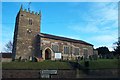
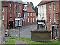
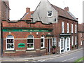
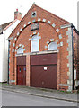
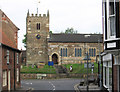
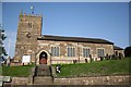
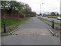
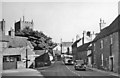
100 photos from this area
Area Information
Key information about the NG22 9AG including its size, population, and administrative classification.
- Area Type
- Postcode
- Area Size
- 8024 m²
- Population
- 1257
- Population Density
- 447 people/km²
House Prices in NG22 9AG
18
Properties
£125,909
Average Sold Price
£43,000
Lowest Price
£195,000
Highest Price
Showing 18 properties
| Address | Type | Beds | Baths | Last Sale Price | Last Sale Date | |
|---|---|---|---|---|---|---|
| 6 Grange Avenue, Ollerton, NG22 9AG | Detached | 3 | - | £195,000 | Oct 2021 | |
| 16 Grange Avenue, Ollerton, NG22 9AG | house | - | - | £186,000 | Sep 2021 | |
| 3 Grange Avenue, Ollerton, NG22 9AG | Bungalow | - | - | £160,000 | Sep 2018 | |
| 1 Grange Avenue, Ollerton, NG22 9AG | Semi-detached | 3 | 1 | £122,500 | Apr 2017 | |
| 15 Grange Avenue, Ollerton, NG22 9AG | Detached | 3 | - | £138,000 | Aug 2016 | |
| 9 Grange Avenue, Ollerton, NG22 9AG | Bungalow | 3 | 1 | £150,000 | Mar 2016 | |
| 7 Grange Avenue, Ollerton, NG22 9AG | Bungalow | - | - | £123,000 | Feb 2006 | |
| Fairways, 5 Grange Avenue, Ollerton, NG22 9AG | Detached | - | - | £125,000 | Mar 2005 | |
| 8 Grange Avenue, Ollerton, NG22 9AG | Detached | - | - | £87,500 | Dec 2002 | |
| 12 Grange Avenue, Ollerton, NG22 9AG | Detached | - | - | £55,000 | Sep 1999 |
Page 1 of 2
Energy Efficiency in NG22 9AG
Amenities
Schools
| Rank | School | Type | Entry gender | Ages |
|---|
Explore more schools in this area
Go to Schools tabDemographics
Household Size
Two person
most common
Accommodation Type
Houses
most common
Tenure
86
majority
Ethnic Group
White
most common
Religion
N/A
most common
Household Composition
N/A
most common
Age
47
median
Elderly (65+ years)
most common
Household Deprivation
N/A
with no deprivation
NS-SEC
30
in Lower managerial occupations
Explore more demographic insights in this area
Go to Demographics tabPlanning
Planning Constraints
- Flood RiskPremium
- Ramsar Wetland SitesPremium
- Area of Outstanding Natural BeautyPremium
- Protected Nature ReservePremium
- Protected WoodlandPremium