Area Overview for NG22 8LA
Photos of NG22 8LA
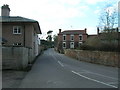
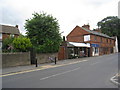
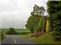
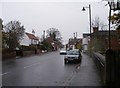
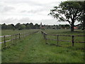
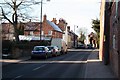
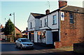
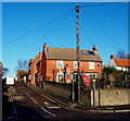
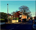
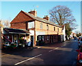
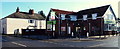
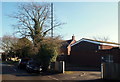
100 photos from this area
Area Information
Key information about the NG22 8LA including its size, population, and administrative classification.
- Area Type
- Postcode
- Area Size
- 3.6 hectares
- Population
- 1994
- Population Density
- 61 people/km²
House Prices in NG22 8LA
43
Properties
£217,634
Average Sold Price
£51,000
Lowest Price
£395,000
Highest Price
Showing 43 properties
| Address | Type | Beds | Baths | Last Sale Price | Last Sale Date | |
|---|---|---|---|---|---|---|
| Sydings, Station Lane, Farnsfield, NG22 8LA | Bungalow | 4 | 2 | £315,000 | Sep 2024 | |
| 48 Station Lane, Farnsfield, NG22 8LA | Semi-detached | 3 | 1 | £248,000 | Sep 2024 | |
| Waverley, Station Lane, Farnsfield, NG22 8LA | Detached | 3 | 2 | £395,000 | Aug 2023 | |
| 24 Station Lane, Farnsfield, NG22 8LA | house | - | - | £315,000 | Oct 2022 | |
| 14 Station Lane, Farnsfield, NG22 8LA | Retail | 4 | 2 | £305,000 | Sep 2022 | |
| 44 Station Lane, Farnsfield, NG22 8LA | Semi-detached | 3 | 1 | £254,950 | May 2021 | |
| 42 Station Lane, Farnsfield, NG22 8LA | house | - | - | £195,000 | Mar 2021 | |
| Woodstead, Station Lane, Farnsfield, NG22 8LA | Bungalow | 3 | 1 | £325,000 | Sep 2020 | |
| 36 Station Lane, Farnsfield, NG22 8LA | Semi-detached | 3 | 1 | £190,000 | Feb 2020 | |
| 58 Station Lane, Farnsfield, NG22 8LA | Semi-detached | 3 | 1 | £192,000 | Sep 2017 |
Page 1 of 5
Energy Efficiency in NG22 8LA
Amenities
Schools
| Rank | School | Type | Entry gender | Ages |
|---|
Explore more schools in this area
Go to Schools tabDemographics
Household Size
Two person
most common
Accommodation Type
Houses
most common
Tenure
74
majority
Ethnic Group
White
most common
Religion
N/A
most common
Household Composition
N/A
most common
Age
47
median
Adults (30-64 years)
most common
Household Deprivation
N/A
with no deprivation
NS-SEC
42
in Lower managerial occupations
Explore more demographic insights in this area
Go to Demographics tabPlanning
Planning Constraints
- Flood RiskPremium
- Ramsar Wetland SitesPremium
- Area of Outstanding Natural BeautyPremium
- Protected Nature ReservePremium
- Protected WoodlandPremium