Area Overview for NG22 8EA
Photos of NG22 8EA
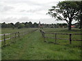
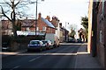
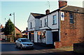
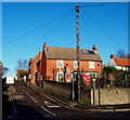
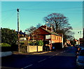
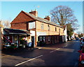
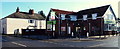
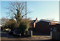
100 photos from this area
Area Information
Key information about the NG22 8EA including its size, population, and administrative classification.
- Area Type
- Postcode
- Area Size
- 1.8 hectares
- Population
- 1788
- Population Density
- 1404 people/km²
House Prices in NG22 8EA
21
Properties
£424,438
Average Sold Price
£235,000
Lowest Price
£980,000
Highest Price
Showing 21 properties
| Address | Type | Beds | Baths | Last Sale Price | Last Sale Date | |
|---|---|---|---|---|---|---|
| Old Manor Farm, Main Street, Farnsfield, NG22 8EA | Detached | 5 | 2 | £565,000 | Jun 2024 | |
| Ridgeway Cottage, Main Street, Farnsfield, NG22 8EA | house | 3 | - | £352,000 | Apr 2022 | |
| Wheatsheaf Cottage, Main Street, Farnsfield, NG22 8EA | Detached | 3 | 3 | £318,500 | Jan 2021 | |
| Grange Farm Cottage, Main Street, Farnsfield, NG22 8EA | Cottage | 3 | 2 | £275,000 | Apr 2019 | |
| Whey Inne Cottage, Main Street, Farnsfield, NG22 8EA | Bungalow | 4 | 2 | £420,000 | Mar 2013 | |
| The Grange, Main Street, Farnsfield, NG22 8EA | Semi-detached | 5 | - | £980,000 | Aug 2012 | |
| Fieldings, Main Street, Farnsfield, NG22 8EA | house | - | - | £235,000 | Jul 2010 | |
| Hescoll Cottage, Main Street, Farnsfield, NG22 8EA | Cottage | 6 | 3 | £250,000 | May 2002 | |
| The Stables, The Old Wheatsheaf, Main Street, Farnsfield, NG22 8EA | Semi-detached | 2 | 2 | - | - | |
| Grange Cottage, Main Street, Farnsfield, NG22 8EA | Detached | 5 | - | - | - |
Page 1 of 3
Energy Efficiency in NG22 8EA
Amenities
Schools
| Rank | School | Type | Entry gender | Ages |
|---|
Explore more schools in this area
Go to Schools tabDemographics
Household Size
Two person
most common
Accommodation Type
Houses
most common
Tenure
86
majority
Ethnic Group
White
most common
Religion
N/A
most common
Household Composition
N/A
most common
Age
47
median
Adults (30-64 years)
most common
Household Deprivation
N/A
with no deprivation
NS-SEC
49
in Lower managerial occupations
Explore more demographic insights in this area
Go to Demographics tabPlanning
Planning Constraints
- Flood RiskPremium
- Ramsar Wetland SitesPremium
- Area of Outstanding Natural BeautyPremium
- Protected Nature ReservePremium
- Protected WoodlandPremium