Area Overview for NG22 0SA
Photos of NG22 0SA
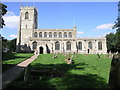
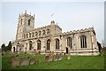
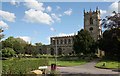
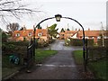
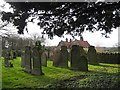
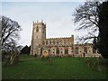
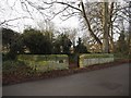
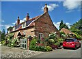
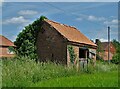
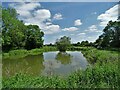
57 photos from this area
Area Information
Key information about the NG22 0SA including its size, population, and administrative classification.
- Area Type
- Postcode
- Area Size
- 41.3 hectares
- Population
- 1223
- Population Density
- 107 people/km²
House Prices in NG22 0SA
32
Properties
£268,680
Average Sold Price
£104,000
Lowest Price
£473,500
Highest Price
Showing 32 properties
| Address | Type | Beds | Baths | Last Sale Price | Last Sale Date | |
|---|---|---|---|---|---|---|
| Wayside, Church Street, East Markham, NG22 0SA | Bungalow | 3 | 2 | £435,000 | Jul 2024 | |
| Bumbles, Church Street, East Markham, NG22 0SA | Bungalow | - | - | £473,500 | Jun 2023 | |
| Barn Cottage, Church Street, East Markham, NG22 0SA | house | - | - | £410,000 | Dec 2022 | |
| Fairfield, Church Street, East Markham, NG22 0SA | Bungalow | 2 | 1 | £200,000 | Feb 2022 | |
| The Rosary, Church Street, East Markham, NG22 0SA | Detached | 3 | 1 | £405,000 | Feb 2021 | |
| Cherry Dene, Church Street, East Markham, NG22 0SA | Bungalow | 3 | 1 | £240,000 | Jan 2019 | |
| Sandygates, Church Street, East Markham, NG22 0SA | Detached | 4 | 1 | £250,000 | May 2013 | |
| Norwood Cottage, Church Street, East Markham, NG22 0SA | Bungalow | - | - | £345,000 | Oct 2012 | |
| West View House, Church Street, East Markham, NG22 0SA | Detached | - | - | £295,000 | Jun 2008 | |
| Sunset View, Church Street, East Markham, NG22 0SA | Detached | 3 | 2 | £245,000 | Nov 2005 |
Page 1 of 4
Energy Efficiency in NG22 0SA
Amenities
Schools
| Rank | School | Type | Entry gender | Ages |
|---|
Explore more schools in this area
Go to Schools tabDemographics
Household Size
Two person
most common
Accommodation Type
Houses
most common
Tenure
87
majority
Ethnic Group
White
most common
Religion
N/A
most common
Household Composition
N/A
most common
Age
47
median
Adults (30-64 years)
most common
Household Deprivation
N/A
with no deprivation
NS-SEC
45
in Lower managerial occupations
Explore more demographic insights in this area
Go to Demographics tabPlanning
Planning Constraints
- Flood RiskPremium
- Ramsar Wetland SitesPremium
- Area of Outstanding Natural BeautyPremium
- Protected Nature ReservePremium
- Protected WoodlandPremium