Area Overview for NG22 0QW
Photos of NG22 0QW
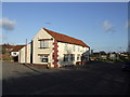
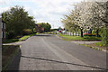
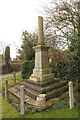
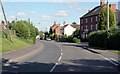
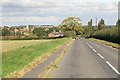
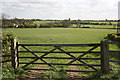
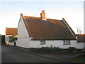
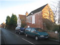
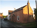
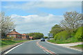
33 photos from this area
Area Information
Key information about the NG22 0QW including its size, population, and administrative classification.
- Area Type
- Postcode
- Area Size
- 12.2 hectares
- Population
- 1223
- Population Density
- 107 people/km²
House Prices in NG22 0QW
30
Properties
£332,071
Average Sold Price
£28,500
Lowest Price
£925,000
Highest Price
Showing 30 properties
| Address | Type | Beds | Baths | Last Sale Price | Last Sale Date | |
|---|---|---|---|---|---|---|
| 3 York Street, East Markham, NG22 0QW | Bungalow | 3 | - | £330,000 | Sep 2025 | |
| York Corner, York Street, East Markham, NG22 0QW | Detached | 4 | 2 | £660,000 | Mar 2025 | |
| Stables Cottage, York Street, East Markham, NG22 0QW | Detached | 3 | 1 | £393,000 | Jan 2024 | |
| York Dene, York Street, East Markham, NG22 0QW | Bungalow | 3 | 2 | £512,000 | Dec 2021 | |
| 5 York Street, East Markham, NG22 0QW | Bungalow | 3 | 1 | £250,000 | Jun 2021 | |
| Sedgebrook, York Street, East Markham, NG22 0QW | Bungalow | - | - | £200,000 | May 2021 | |
| 2, York Place, York Street, East Markham, NG22 0QW | house | - | - | £202,000 | Jan 2021 | |
| Markham House, York Street, East Markham, NG22 0QW | house | - | - | £925,000 | Feb 2020 | |
| Salisbury House, York Street, East Markham, NG22 0QW | Detached | 6 | 4 | £679,000 | Aug 2019 | |
| 9 York Street, East Markham, NG22 0QW | Bungalow | 3 | 2 | £267,500 | Jan 2019 |
Page 1 of 3
Energy Efficiency in NG22 0QW
Amenities
Schools
| Rank | School | Type | Entry gender | Ages |
|---|
Explore more schools in this area
Go to Schools tabDemographics
Household Size
Two person
most common
Accommodation Type
Houses
most common
Tenure
87
majority
Ethnic Group
White
most common
Religion
N/A
most common
Household Composition
N/A
most common
Age
47
median
Adults (30-64 years)
most common
Household Deprivation
N/A
with no deprivation
NS-SEC
45
in Lower managerial occupations
Explore more demographic insights in this area
Go to Demographics tabPlanning
Planning Constraints
- Flood RiskPremium
- Ramsar Wetland SitesPremium
- Area of Outstanding Natural BeautyPremium
- Protected Nature ReservePremium
- Protected WoodlandPremium