Area Overview for NG22 0EB
Photos of NG22 0EB
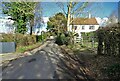
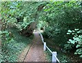
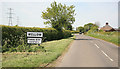
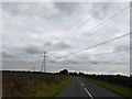
11 photos from this area
Area Information
Key information about the NG22 0EB including its size, population, and administrative classification.
- Area Type
- Postcode
- Area Size
- 3.3 hectares
- Population
- 2314
- Population Density
- 27 people/km²
House Prices in NG22 0EB
18
Properties
£357,806
Average Sold Price
£122,500
Lowest Price
£642,750
Highest Price
Showing 18 properties
| Address | Type | Beds | Baths | Last Sale Price | Last Sale Date | |
|---|---|---|---|---|---|---|
| Stonebank, Potter Lane, Wellow, NG22 0EB | Detached | 4 | 2 | £642,750 | Aug 2025 | |
| Appleby, Potter Lane, Wellow, NG22 0EB | Bungalow | 4 | 2 | £395,000 | Mar 2024 | |
| Shardale, Potter Lane, Wellow, NG22 0EB | Detached | 5 | 3 | £490,000 | Jun 2021 | |
| Manderley, Potter Lane, Wellow, NG22 0EB | house | 4 | - | £335,000 | Jun 2017 | |
| Sycamore Corner, Potter Lane, Wellow, NG22 0EB | house | - | - | £270,000 | Oct 2016 | |
| Mayfield, Potter Lane, Wellow, NG22 0EB | Detached | 4 | 2 | £400,000 | Jul 2013 | |
| The Old Vicarage, Potter Lane, Wellow, NG22 0EB | house | 4 | - | £350,000 | Jun 2011 | |
| Grasmere, Potter Lane, Wellow, NG22 0EB | Detached | - | - | £215,000 | Jul 2000 | |
| Mowcroft, Potter Lane, Wellow, NG22 0EB | house | - | - | £122,500 | Jan 1999 | |
| Old Farm, Potter Lane, Wellow, NG22 0EB | Detached | 4 | 2 | - | - |
Page 1 of 2
Energy Efficiency in NG22 0EB
Amenities
Schools
| Rank | School | Type | Entry gender | Ages |
|---|
Explore more schools in this area
Go to Schools tabDemographics
Household Size
Two person
most common
Accommodation Type
Houses
most common
Tenure
74
majority
Ethnic Group
White
most common
Religion
N/A
most common
Household Composition
N/A
most common
Age
47
median
Adults (30-64 years)
most common
Household Deprivation
N/A
with no deprivation
NS-SEC
39
in Lower managerial occupations
Explore more demographic insights in this area
Go to Demographics tabPlanning
Planning Constraints
- Flood RiskPremium
- Ramsar Wetland SitesPremium
- Area of Outstanding Natural BeautyPremium
- Protected Nature ReservePremium
- Protected WoodlandPremium