Area Overview for NG21 9ER
Photos of NG21 9ER

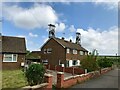
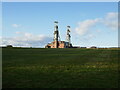
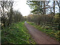
35 photos from this area
Area Information
Key information about the NG21 9ER including its size, population, and administrative classification.
- Area Type
- Postcode
- Area Size
- 8.7 hectares
- Population
- 1571
- Population Density
- 1741 people/km²
House Prices in NG21 9ER
42
Properties
£89,750
Average Sold Price
£30,000
Lowest Price
£159,000
Highest Price
Showing 42 properties
| Address | Type | Beds | Baths | Last Sale Price | Last Sale Date | |
|---|---|---|---|---|---|---|
| 68 Highfield Road, Clipstone, NG21 9ER | house | - | - | £159,000 | May 2022 | |
| 36 Highfield Road, Clipstone, NG21 9ER | house | - | - | £90,000 | Oct 2020 | |
| 62 Highfield Road, Clipstone, NG21 9ER | Semi-detached | 3 | 1 | £105,000 | May 2018 | |
| 56 Highfield Road, Clipstone, NG21 9ER | Flat | 2 | - | £76,000 | Dec 2016 | |
| 40 Highfield Road, Clipstone, NG21 9ER | Semi-detached | 3 | 1 | £98,000 | Dec 2016 | |
| 50 Highfield Road, Clipstone, NG21 9ER | Semi-detached | 3 | 1 | £105,000 | Nov 2016 | |
| 48 Highfield Road, Clipstone, NG21 9ER | Semi-detached | 3 | - | £77,000 | Mar 2013 | |
| 30 Highfield Road, Clipstone, NG21 9ER | Semi-detached | - | - | £80,000 | Sep 2012 | |
| 26 Highfield Road, Clipstone, NG21 9ER | house | 3 | - | £103,000 | Dec 2011 | |
| 6 Highfield Road, Clipstone, NG21 9ER | house | 3 | 1 | £118,000 | Sep 2009 |
Page 1 of 5
Energy Efficiency in NG21 9ER
Amenities
Schools
| Rank | School | Type | Entry gender | Ages |
|---|
Explore more schools in this area
Go to Schools tabDemographics
Household Size
Family (3-5 people)
most common
Accommodation Type
Houses
most common
Tenure
90
majority
Ethnic Group
White
most common
Religion
N/A
most common
Household Composition
N/A
most common
Age
47
median
Adults (30-64 years)
most common
Household Deprivation
N/A
with no deprivation
NS-SEC
43
in Lower managerial occupations
Explore more demographic insights in this area
Go to Demographics tabPlanning
Planning Constraints
- Flood RiskPremium
- Ramsar Wetland SitesPremium
- Area of Outstanding Natural BeautyPremium
- Protected Nature ReservePremium
- Protected WoodlandPremium