Area Overview for NG21 0FR
Photos of NG21 0FR
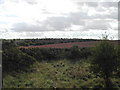
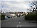
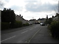
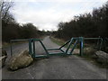
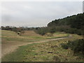
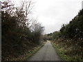
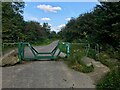
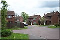
11 photos from this area
Area Information
Key information about the NG21 0FR including its size, population, and administrative classification.
- Area Type
- Postcode
- Area Size
- 7988 m²
- Population
- 1484
- Population Density
- 6399 people/km²
House Prices in NG21 0FR
27
Properties
£93,495
Average Sold Price
£21,000
Lowest Price
£160,000
Highest Price
Showing 27 properties
| Address | Type | Beds | Baths | Last Sale Price | Last Sale Date | |
|---|---|---|---|---|---|---|
| 18 Hall Close, Rainworth, NG21 0FR | Detached | 2 | 1 | £148,000 | Feb 2024 | |
| 11 Hall Close, Rainworth, NG21 0FR | Semi-detached | 2 | 1 | £150,000 | May 2022 | |
| 21 Hall Close, Rainworth, NG21 0FR | house | 2 | 1 | £112,000 | Nov 2019 | |
| 20 Hall Close, Rainworth, NG21 0FR | Terraced | 1 | - | £72,500 | Jul 2019 | |
| 6 Hall Close, Rainworth, NG21 0FR | house | - | - | £115,000 | May 2017 | |
| 19 Hall Close, Rainworth, NG21 0FR | Semi-detached | 1 | 1 | £58,000 | Sep 2016 | |
| 10 Hall Close, Rainworth, NG21 0FR | Semi-detached | 2 | - | £105,000 | Dec 2015 | |
| 28 Hall Close, Rainworth, NG21 0FR | Semi-detached | 3 | - | £139,950 | Jul 2015 | |
| 14 Hall Close, Rainworth, NG21 0FR | Detached | 2 | 1 | £90,000 | Nov 2013 | |
| 17 Hall Close, Rainworth, NG21 0FR | house | 1 | - | £49,000 | Aug 2013 |
Page 1 of 3
Energy Efficiency in NG21 0FR
Amenities
Schools
| Rank | School | Type | Entry gender | Ages |
|---|
Explore more schools in this area
Go to Schools tabDemographics
Household Size
Family (3-5 people)
most common
Accommodation Type
Houses
most common
Tenure
64
majority
Ethnic Group
White
most common
Religion
N/A
most common
Household Composition
N/A
most common
Age
47
median
Adults (30-64 years)
most common
Household Deprivation
N/A
with no deprivation
NS-SEC
21
in Lower managerial occupations
Explore more demographic insights in this area
Go to Demographics tabPlanning
Planning Constraints
- Flood RiskPremium
- Ramsar Wetland SitesPremium
- Area of Outstanding Natural BeautyPremium
- Protected Nature ReservePremium
- Protected WoodlandPremium