Area Overview for NG20 9PA
Photos of NG20 9PA
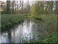
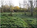


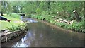
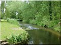
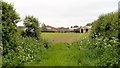
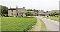
40 photos from this area
Area Information
Key information about the NG20 9PA including its size, population, and administrative classification.
- Area Type
- Postcode
- Area Size
- 5.2 hectares
- Population
- 1581
- Population Density
- 663 people/km²
House Prices in NG20 9PA
14
Properties
£90,167
Average Sold Price
£70,000
Lowest Price
£108,000
Highest Price
Showing 14 properties
| Address | Type | Beds | Baths | Last Sale Price | Last Sale Date | |
|---|---|---|---|---|---|---|
| Charlean, Netherfield Lane, Meden Vale, NG20 9PA | office_workshop | - | - | £92,500 | Apr 2015 | |
| 103 Netherfield Lane, Meden Vale, NG20 9PA | Land | 4 | 1 | £108,000 | Sep 2013 | |
| Copper Beeches, Netherfield Lane, Meden Vale, NG20 9PA | house | - | - | £70,000 | Apr 1997 | |
| Flat Above, The Three Lions, Netherfield Lane, Meden Vale, NG20 9PA | Land | 3 | 1 | - | - | |
| Caravan At Rear Of, The Three Lions, Netherfield Lane, Meden Vale, NG20 9PA | Mobile Home | - | - | - | - | |
| Flat, Copper Beeches, Netherfield Lane, Meden Vale, NG20 9PA | Flat | - | - | - | - | |
| School View, Netherfield Lane, Meden Vale, NG20 9PA | Detached | - | - | - | - | |
| Eastlands Junior Caretakers House, Netherfield Lane, Meden Vale, NG20 9PA | Detached | - | - | - | - | |
| 102 Netherfield Lane, Meden Vale, NG20 9PA | Semi-detached | 3 | 2 | - | - | |
| Flat, Netherfield Stores, Netherfield Lane, Meden Vale, NG20 9PA | Flat | - | - | - | - |
Page 1 of 2
Energy Efficiency in NG20 9PA
Amenities
Schools
| Rank | School | Type | Entry gender | Ages |
|---|
Explore more schools in this area
Go to Schools tabDemographics
Household Size
Family (3-5 people)
most common
Accommodation Type
Houses
most common
Tenure
64
majority
Ethnic Group
White
most common
Religion
N/A
most common
Household Composition
N/A
most common
Age
47
median
Adults (30-64 years)
most common
Household Deprivation
N/A
with no deprivation
NS-SEC
16
in Lower managerial occupations
Explore more demographic insights in this area
Go to Demographics tabPlanning
Planning Constraints
- Flood RiskPremium
- Ramsar Wetland SitesPremium
- Area of Outstanding Natural BeautyPremium
- Protected Nature ReservePremium
- Protected WoodlandPremium