Area Overview for NG20 9HU
Photos of NG20 9HU
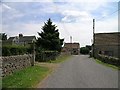
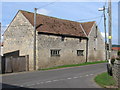
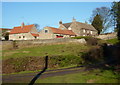
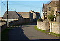
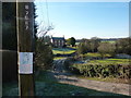
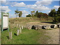
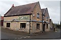
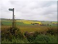
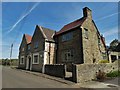

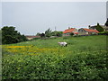
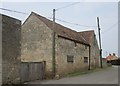
43 photos from this area
Area Information
Key information about the NG20 9HU including its size, population, and administrative classification.
- Area Type
- Postcode
- Area Size
- 95.6 hectares
- Population
- 1300
- Population Density
- 250 people/km²
House Prices in NG20 9HU
22
Properties
£328,929
Average Sold Price
£185,000
Lowest Price
£590,000
Highest Price
Showing 22 properties
| Address | Type | Beds | Baths | Last Sale Price | Last Sale Date | |
|---|---|---|---|---|---|---|
| School Bell Cottage, Whaley Road, Whaley, NG20 9HU | Semi-detached | 4 | 2 | £590,000 | Mar 2025 | |
| Park House, Whaley Road, Whaley, NG20 9HU | Detached | 4 | 1 | £570,000 | Jul 2023 | |
| Wood View Cottage, Whaley Road, Whaley, NG20 9HU | Detached | 2 | 1 | £250,000 | Nov 2018 | |
| The Old Cornmill, Whaley Road, Whaley, NG20 9HU | Detached | 2 | 1 | £250,000 | Apr 2017 | |
| The Cottage, Whaley Road, Whaley, NG20 9HU | house | 2 | 2 | £250,000 | Mar 2009 | |
| School House, Whaley Road, Whaley, NG20 9HU | Semi-detached | - | - | £185,000 | Oct 2002 | |
| Forest Cottage, Whaley Road, Whaley, NG20 9HU | Detached | - | - | £207,500 | Mar 1999 | |
| Living Accommodation, The Black Horse Inn, Whaley Road, Whaley, NG20 9HU | Retail | 3 | 1 | - | - | |
| Water Reclamation Works, Whaley Road, Whaley, NG20 9HU | Industrial | - | - | - | - | |
| Annex, Park House, Whaley Road, Whaley, NG20 9HU | Flat | - | - | - | - |
Page 1 of 3
Energy Efficiency in NG20 9HU
Amenities
Schools
| Rank | School | Type | Entry gender | Ages |
|---|
Explore more schools in this area
Go to Schools tabDemographics
Household Size
Two person
most common
Accommodation Type
Houses
most common
Tenure
60
majority
Ethnic Group
White
most common
Religion
N/A
most common
Household Composition
N/A
most common
Age
47
median
Adults (30-64 years)
most common
Household Deprivation
N/A
with no deprivation
NS-SEC
28
in Lower managerial occupations
Explore more demographic insights in this area
Go to Demographics tabPlanning
Planning Constraints
- Flood RiskPremium
- Ramsar Wetland SitesPremium
- Area of Outstanding Natural BeautyPremium
- Protected Nature ReservePremium
- Protected WoodlandPremium