Area Overview for NG20 8XN
Photos of NG20 8XN
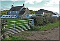
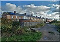
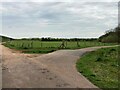
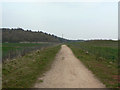
21 photos from this area
Area Information
Key information about the NG20 8XN including its size, population, and administrative classification.
- Area Type
- Postcode
- Area Size
- 5088 m²
- Population
- 1776
- Population Density
- 328 people/km²
House Prices in NG20 8XN
67
Properties
£150,434
Average Sold Price
£70,000
Lowest Price
£210,000
Highest Price
Showing 67 properties
| Address | Type | Beds | Baths | Last Sale Price | Last Sale Date | |
|---|---|---|---|---|---|---|
| 19 Hewett Street, Warsop Vale, NG20 8XN | house | 4 | 3 | £200,000 | Sep 2024 | |
| 10 Hewett Street, Warsop Vale, NG20 8XN | Semi-detached | 3 | 1 | £177,000 | Sep 2024 | |
| 21 Hewett Street, Warsop Vale, NG20 8XN | house | 4 | 2 | £202,500 | Mar 2024 | |
| 3 Hewett Street, Warsop Vale, NG20 8XN | Semi-detached | 4 | 2 | £210,000 | Feb 2023 | |
| 20 Hewett Street, Warsop Vale, NG20 8XN | Retail | 2 | 1 | £142,000 | Apr 2022 | |
| 2 Hewett Street, Warsop Vale, NG20 8XN | Semi-detached | 2 | 1 | £135,000 | Mar 2022 | |
| 8 Hewett Street, Warsop Vale, NG20 8XN | Semi-detached | 3 | 1 | £141,000 | Feb 2022 | |
| 9 Hewett Street, Warsop Vale, NG20 8XN | house | - | - | £209,000 | Jul 2021 | |
| 11 Hewett Street, Warsop Vale, NG20 8XN | house | - | - | £190,000 | Jun 2021 | |
| 14 Hewett Street, Warsop Vale, NG20 8XN | Semi-detached | 3 | 2 | £128,000 | Mar 2021 |
Page 1 of 7
Energy Efficiency in NG20 8XN
Amenities
Schools
| Rank | School | Type | Entry gender | Ages |
|---|
Explore more schools in this area
Go to Schools tabDemographics
Household Size
Family (3-5 people)
most common
Accommodation Type
Houses
most common
Tenure
60
majority
Ethnic Group
White
most common
Religion
N/A
most common
Household Composition
N/A
most common
Age
47
median
Adults (30-64 years)
most common
Household Deprivation
N/A
with no deprivation
NS-SEC
18
in Lower managerial occupations
Explore more demographic insights in this area
Go to Demographics tabPlanning
Planning Constraints
- Flood RiskPremium
- Ramsar Wetland SitesPremium
- Area of Outstanding Natural BeautyPremium
- Protected Nature ReservePremium
- Protected WoodlandPremium