Area Overview for NG20 8SZ
Photos of NG20 8SZ

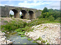
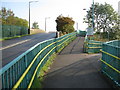
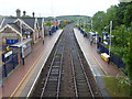
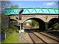
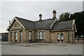
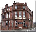
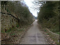
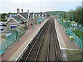
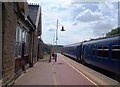
25 photos from this area
Area Information
Key information about the NG20 8SZ including its size, population, and administrative classification.
- Area Type
- Postcode
- Area Size
- 9878 m²
- Population
- 1858
- Population Density
- 2456 people/km²
House Prices in NG20 8SZ
19
Properties
£90,883
Average Sold Price
£12,950
Lowest Price
£140,000
Highest Price
Showing 19 properties
| Address | Type | Beds | Baths | Last Sale Price | Last Sale Date | |
|---|---|---|---|---|---|---|
| 58 Station Road, Shirebrook, NG20 8SZ | house | 3 | 1 | £135,000 | Sep 2025 | |
| 66 Station Road, Shirebrook, NG20 8SZ | house | 3 | 1 | £105,000 | Apr 2025 | |
| 60 Station Road, Shirebrook, NG20 8SZ | Terraced | 1 | 1 | £140,000 | Feb 2023 | |
| 56 Station Road, Shirebrook, NG20 8SZ | house | - | - | £98,500 | Mar 2022 | |
| 52 Station Road, Shirebrook, NG20 8SZ | house | - | - | £92,500 | Apr 2021 | |
| 78 Station Road, Shirebrook, NG20 8SZ | Terraced | - | - | £26,000 | Jun 2012 | |
| 50 Station Road, Shirebrook, NG20 8SZ | Terraced | 1 | 1 | £120,000 | Nov 2007 | |
| 72 Station Road, Shirebrook, NG20 8SZ | house | - | - | £88,000 | Jun 2006 | |
| 86 Station Road, Shirebrook, NG20 8SZ | Terraced | 3 | 1 | £12,950 | Sep 1995 | |
| 68 Station Road, Shirebrook, NG20 8SZ | house | 3 | 1 | - | - |
Page 1 of 2
Energy Efficiency in NG20 8SZ
Amenities
Schools
| Rank | School | Type | Entry gender | Ages |
|---|
Explore more schools in this area
Go to Schools tabDemographics
Household Size
One person
most common
Accommodation Type
Houses
most common
Tenure
34
majority
Ethnic Group
White
most common
Religion
N/A
most common
Household Composition
N/A
most common
Age
47
median
Adults (30-64 years)
most common
Household Deprivation
N/A
with no deprivation
NS-SEC
11
in Lower managerial occupations
Explore more demographic insights in this area
Go to Demographics tabPlanning
Planning Constraints
- Flood RiskPremium
- Ramsar Wetland SitesPremium
- Area of Outstanding Natural BeautyPremium
- Protected Nature ReservePremium
- Protected WoodlandPremium