Area Overview for NG20 8QF
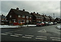
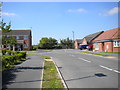
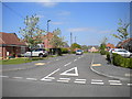
Photos of NG20 8QF


Area Information
Living in NG20 8QF means residing within a compact residential cluster covering 5.9 hectares. This specific postcode area holds a population of 1346, creating a tightly knit environment where neighbours are often within immediate sight. You are located in a setting defined by its modest scale, which fosters a sense of community rather than urban anonymity. The area functions as a distinct residential zone rather than a sprawling suburb, with every home situated in close proximity to its counterparts. Prospective buyers here find themselves in a location that balances seclusion with accessibility to local services. The small footprint of the postcode ensures that daily commutes to nearby town centres remain manageable, yet the area retains a residential focus. You will notice that the built environment is efficient, with little wasteful greenfield expansion required for development. Life here revolves around familiarity and quiet convenience, making it a practical choice for those seeking a defined neighbourhood rather than a vast district. The density is managed carefully, supporting a lifestyle where you know your surroundings without feeling confined.
- Area Type
- Postcode
- Area Size
- 5.9 hectares
- Population
- 1346
- Population Density
- 1947 people/km²
The property market in NG20 8QF is characterised by a clear preference for houses over other housing formats. With 40% of the population owning their homes, the area possesses a solid foundation of owner-occupied stock. You will find that detached and semi-detached properties likely form the bulk of the housing types available. There are no apartments or flats recorded within this postcode, which simplifies the buying process for those seeking traditional family homes. The remaining 60% of residents rely on the rental market, indicating a demand for affordable houses in this postcode. The small area size of 5.9 hectares constrains the total number of properties available for purchase. This scarcity means that any house on the market will attract attention from buyers looking for specific house types rather than generic housing. New builds are unlikely to change the character of the area significantly due to the limited land availability. Buyers should anticipate a market where property types are fixed, and modification to building styles is not an option. The housing stock appears stable and geared towards longevity rather than short-term turnover.
House Prices in NG20 8QF
Showing 3 properties
| Address | Type | Beds | Baths | Last Sale Price | Last Sale Date | |
|---|---|---|---|---|---|---|
| Stubbin Wood School Snack Cabin, Shirebrook Academy School, Common Lane, Shirebrook, NG20 8QF | education | - | - | - | - | |
| Stubbin Wood School, Common Lane, Shirebrook, NG20 8QF | commercial | - | - | - | - | |
| Shirebrook Academy Haf, Shirebrook Academy School, Common Lane, Shirebrook, NG20 8QF | commercial | - | - | - | - |
Energy Efficiency in NG20 8QF
Living in NG20 8QF offers practical access to essential amenities within a short travel distance. Residents have immediate access to five retail locations, including Aldi Shirebrook, Co-op Shirebrook, and Lidl Shirebrook. These supermarkets provide weekly grocery shopping, essentials, and household goods without requiring a long journey. For rail connections, five stations serve the area, with Shirebrook Railway Station being the most direct link to wider networks. Langwith and Mansfield Woodhouse Railway Station form the secondary transit points for regional travel. You can combine local retail needs with public transport options for commuting to larger employment centres. The proximity of these amenities reduces the need for a private car for basic shopping tasks. Dining options are likely available within the local town centre, though specific restaurants are not listed for this micro-postcode. The lifestyle here balances suburban convenience with the necessity of short drives or bus rides for major leisure activities. Residents value the ability to complete daily errands efficiently without leaving the village.
Amenities
Schools
Families considering schools near NG20 8QF have three main options in their immediate vicinity. Shirebrook School operates as a primary institution, catering to younger children within the local catchment. Shirebrook Academy serves as the secondary academy option, currently holding a satisfactory Ofsted rating. This rating confirms that the academy meets expected standards for education and student safety. You will also find Stubbin Wood School listed as a special school, providing necessary support for students with specific educational needs. The presence of a primary school, a special school, and an academy indicates a diverse educational provision for the neighbourhood. There are no sixth-form colleges or private institutions noted specifically for this postcode cluster. Parents aged 30 to 64 find this mix practical, as the primary and secondary schools cover the core years of compulsory education. The satisfactory rating of Shirebrook Academy provides reassurance for those prioritising academic performance. While special needs provision exists locally, some families might look further afield for comprehensive education hubs. The school options reflect the community's composition, prioritising accessibility for the 1346 residents in the area.
| Rank | School | Type | Entry gender | Ages |
|---|
Explore more schools in this area
Go to Schools tabDemographics
The community in NG20 8QF is defined by a median age of 47 years, establishing a mature demographic profile. Adults aged between 30 and 64 years represent the most common age range within the population, indicating a neighbourhood suited to established households. Child-free couples and families with older children dominate the scene, while young families or single students are relatively uncommon. House ownership stands at exactly 40%, meaning the remaining 60% of residents are likely tenants. This split suggests a balanced market where both buying inherited or first-time properties and renting remain viable options. The accommodation type is strictly houses, offering privacy and garden space that flats or apartments cannot provide. The predominant ethnic group is White, reflecting the historical settlement patterns of the region. There is no diversity data suggesting significant minority populations within this specific cluster. For residents, this demographic consistency implies a stable community with shared life stages and similar values. Lower deprivation correlates with the older age profile, though specific deprivation indices are not listed for this micro-area. The environment caters well to those retired or nearing retirement, rather than the younger professional demographic.
Household Size
Accommodation Type
Tenure
Ethnic Group
Religion
Household Composition
Age
Household Deprivation
NS-SEC
Explore more demographic insights in this area
Go to Demographics tabPlanning
Planning Constraints
- Flood RiskPremium
- Ramsar Wetland SitesPremium
- Area of Outstanding Natural BeautyPremium
- Protected Nature ReservePremium
- Protected WoodlandPremium