Area Overview for NG20 8PW
Photos of NG20 8PW
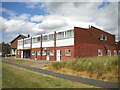
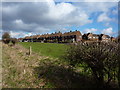
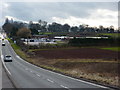
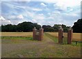
17 photos from this area
Area Information
Key information about the NG20 8PW including its size, population, and administrative classification.
- Area Type
- Postcode
- Area Size
- 1.1 hectares
- Population
- 1358
- Population Density
- 3299 people/km²
House Prices in NG20 8PW
16
Properties
£109,636
Average Sold Price
£75,000
Lowest Price
£140,000
Highest Price
Showing 16 properties
| Address | Type | Beds | Baths | Last Sale Price | Last Sale Date | |
|---|---|---|---|---|---|---|
| 59 Carter Lane, Shirebrook, NG20 8PW | Semi-detached | 3 | 1 | £130,000 | Jun 2024 | |
| 35 Carter Lane, Shirebrook, NG20 8PW | house | 2 | 1 | £140,000 | Jan 2024 | |
| 37 Carter Lane, Shirebrook, NG20 8PW | house | - | - | £105,000 | Jun 2021 | |
| 57 Carter Lane, Shirebrook, NG20 8PW | house | - | - | £125,000 | Jun 2021 | |
| 39 Carter Lane, Shirebrook, NG20 8PW | house | - | - | £109,950 | Aug 2018 | |
| 41 Carter Lane, Shirebrook, NG20 8PW | house | - | - | £82,500 | Dec 2014 | |
| 49 Carter Lane, Shirebrook, NG20 8PW | house | - | - | £75,000 | Aug 2003 | |
| 43 Carter Lane, Shirebrook, NG20 8PW | house | - | - | - | - | |
| 47 Carter Lane, Shirebrook, NG20 8PW | house | - | - | - | - | |
| 45 Carter Lane, Shirebrook, NG20 8PW | house | - | - | - | - |
Page 1 of 2
Energy Efficiency in NG20 8PW
Amenities
Schools
| Rank | School | Type | Entry gender | Ages |
|---|
Explore more schools in this area
Go to Schools tabDemographics
Household Size
Family (3-5 people)
most common
Accommodation Type
Houses
most common
Tenure
48
majority
Ethnic Group
White
most common
Religion
N/A
most common
Household Composition
N/A
most common
Age
47
median
Adults (30-64 years)
most common
Household Deprivation
N/A
with no deprivation
NS-SEC
12
in Lower managerial occupations
Explore more demographic insights in this area
Go to Demographics tabPlanning
Planning Constraints
- Flood RiskPremium
- Ramsar Wetland SitesPremium
- Area of Outstanding Natural BeautyPremium
- Protected Nature ReservePremium
- Protected WoodlandPremium