Area Overview for NG20 8NL
Photos of NG20 8NL
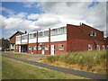
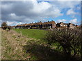
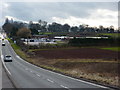
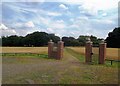
17 photos from this area
Area Information
Key information about the NG20 8NL including its size, population, and administrative classification.
- Area Type
- Postcode
- Area Size
- 1.2 hectares
- Population
- 1604
- Population Density
- 4615 people/km²
House Prices in NG20 8NL
26
Properties
£81,132
Average Sold Price
£32,000
Lowest Price
£142,000
Highest Price
Showing 26 properties
| Address | Type | Beds | Baths | Last Sale Price | Last Sale Date | |
|---|---|---|---|---|---|---|
| 48 Chestnut Drive, Shirebrook, NG20 8NL | Semi-detached | 3 | 1 | £140,000 | Apr 2025 | |
| 70 Chestnut Drive, Shirebrook, NG20 8NL | Semi-detached | 2 | 1 | £142,000 | Oct 2024 | |
| 86 Chestnut Drive, Shirebrook, NG20 8NL | Semi-detached | 3 | 1 | £68,000 | Sep 2016 | |
| 64 Chestnut Drive, Shirebrook, NG20 8NL | Semi-detached | 3 | 1 | £110,000 | Jul 2016 | |
| 50 Chestnut Drive, Shirebrook, NG20 8NL | Semi-detached | 3 | 2 | £73,000 | Jan 2016 | |
| 80 Chestnut Drive, Shirebrook, NG20 8NL | Semi-detached | 3 | 1 | £53,500 | May 2013 | |
| 38 Chestnut Drive, Shirebrook, NG20 8NL | Semi-detached | 3 | - | £71,000 | Jul 2012 | |
| 40 Chestnut Drive, Shirebrook, NG20 8NL | house | 3 | - | £81,000 | Jun 2010 | |
| 74 Chestnut Drive, Shirebrook, NG20 8NL | house | - | - | £84,955 | Oct 2006 | |
| 54 Chestnut Drive, Shirebrook, NG20 8NL | Semi-detached | - | - | £32,000 | May 2002 |
Page 1 of 3
Energy Efficiency in NG20 8NL
Amenities
Schools
| Rank | School | Type | Entry gender | Ages |
|---|
Explore more schools in this area
Go to Schools tabDemographics
Household Size
Family (3-5 people)
most common
Accommodation Type
Houses
most common
Tenure
72
majority
Ethnic Group
White
most common
Religion
N/A
most common
Household Composition
N/A
most common
Age
47
median
Adults (30-64 years)
most common
Household Deprivation
N/A
with no deprivation
NS-SEC
18
in Lower managerial occupations
Explore more demographic insights in this area
Go to Demographics tabPlanning
Planning Constraints
- Flood RiskPremium
- Ramsar Wetland SitesPremium
- Area of Outstanding Natural BeautyPremium
- Protected Nature ReservePremium
- Protected WoodlandPremium