Area Overview for NG20 8BQ
Photos of NG20 8BQ

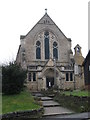
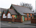
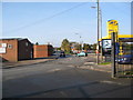
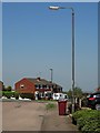
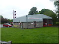
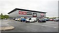
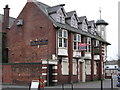
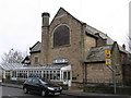
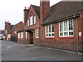

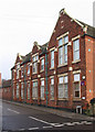
25 photos from this area
Area Information
Key information about the NG20 8BQ including its size, population, and administrative classification.
- Area Type
- Postcode
- Area Size
- 1.5 hectares
- Population
- 2233
- Population Density
- 634 people/km²
House Prices in NG20 8BQ
41
Properties
£75,686
Average Sold Price
£11,250
Lowest Price
£135,000
Highest Price
Showing 41 properties
| Address | Type | Beds | Baths | Last Sale Price | Last Sale Date | |
|---|---|---|---|---|---|---|
| 20 Central Drive, Shirebrook, NG20 8BQ | Terraced | 3 | 1 | £132,000 | Oct 2024 | |
| 74 Central Drive, Shirebrook, NG20 8BQ | Terraced | 3 | 1 | £109,000 | Sep 2023 | |
| 38 Central Drive, Shirebrook, NG20 8BQ | Terraced | 3 | 1 | £82,000 | Mar 2023 | |
| 36 Central Drive, Shirebrook, NG20 8BQ | house | - | - | £80,000 | Dec 2022 | |
| 34 Central Drive, Shirebrook, NG20 8BQ | house | - | - | £85,000 | Nov 2022 | |
| 66 Central Drive, Shirebrook, NG20 8BQ | Terraced | 3 | 1 | £98,500 | Jul 2022 | |
| 30 Central Drive, Shirebrook, NG20 8BQ | Detached | 3 | 1 | £105,000 | May 2022 | |
| 8 Central Drive, Shirebrook, NG20 8BQ | Terraced | 3 | 1 | £85,000 | Jan 2022 | |
| 12 Central Drive, Shirebrook, NG20 8BQ | Terraced | - | - | £63,000 | Sep 2021 | |
| 62 Central Drive, Shirebrook, NG20 8BQ | Terraced | 3 | 1 | £85,000 | May 2021 |
Page 1 of 5
Energy Efficiency in NG20 8BQ
Amenities
Schools
| Rank | School | Type | Entry gender | Ages |
|---|
Explore more schools in this area
Go to Schools tabDemographics
Household Size
Two person
most common
Accommodation Type
Houses
most common
Tenure
52
majority
Ethnic Group
White
most common
Religion
N/A
most common
Household Composition
N/A
most common
Age
47
median
Adults (30-64 years)
most common
Household Deprivation
N/A
with no deprivation
NS-SEC
14
in Lower managerial occupations
Explore more demographic insights in this area
Go to Demographics tabPlanning
Planning Constraints
- Flood RiskPremium
- Ramsar Wetland SitesPremium
- Area of Outstanding Natural BeautyPremium
- Protected Nature ReservePremium
- Protected WoodlandPremium