Area Overview for NG20 0HP
Photos of NG20 0HP
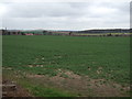
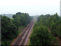

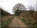
15 photos from this area
Area Information
Key information about the NG20 0HP including its size, population, and administrative classification.
- Area Type
- Postcode
- Area Size
- 1.9 hectares
- Population
- 1417
- Population Density
- 165 people/km²
House Prices in NG20 0HP
31
Properties
£114,415
Average Sold Price
£29,500
Lowest Price
£185,000
Highest Price
Showing 31 properties
| Address | Type | Beds | Baths | Last Sale Price | Last Sale Date | |
|---|---|---|---|---|---|---|
| 22 Robin Hood Avenue, Warsop, NG20 0HP | Semi-detached | 3 | 1 | £155,000 | Dec 2025 | |
| 14 Robin Hood Avenue, Warsop, NG20 0HP | Semi-detached | 3 | 1 | £185,000 | Dec 2023 | |
| 2B Robin Hood Avenue, Warsop, NG20 0HP | house | - | - | £160,000 | Mar 2023 | |
| 2A Robin Hood Avenue, Warsop, NG20 0HP | house | - | - | £165,000 | Mar 2023 | |
| 2C Robin Hood Avenue, Warsop, NG20 0HP | house | - | - | £165,000 | Mar 2023 | |
| 12 Robin Hood Avenue, Warsop, NG20 0HP | Terraced | 3 | - | £140,000 | Jun 2021 | |
| 40 Robin Hood Avenue, Warsop, NG20 0HP | Detached | 3 | 1 | £124,000 | Apr 2021 | |
| 30 Robin Hood Avenue, Warsop, NG20 0HP | house | - | - | £95,000 | Aug 2019 | |
| 8 Robin Hood Avenue, Warsop, NG20 0HP | Semi-detached | 3 | 1 | £115,000 | Feb 2019 | |
| 4 Robin Hood Avenue, Warsop, NG20 0HP | Semi-detached | 3 | - | £120,000 | Oct 2017 |
Page 1 of 4
Energy Efficiency in NG20 0HP
Amenities
Schools
| Rank | School | Type | Entry gender | Ages |
|---|
Explore more schools in this area
Go to Schools tabDemographics
Household Size
Two person
most common
Accommodation Type
Houses
most common
Tenure
63
majority
Ethnic Group
White
most common
Religion
N/A
most common
Household Composition
N/A
most common
Age
47
median
Adults (30-64 years)
most common
Household Deprivation
N/A
with no deprivation
NS-SEC
24
in Lower managerial occupations
Explore more demographic insights in this area
Go to Demographics tabPlanning
Planning Constraints
- Flood RiskPremium
- Ramsar Wetland SitesPremium
- Area of Outstanding Natural BeautyPremium
- Protected Nature ReservePremium
- Protected WoodlandPremium