Area Overview for NG20 0BP
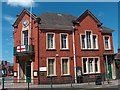
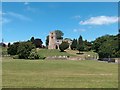
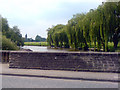
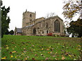
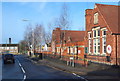
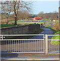
Photos of NG20 0BP


Area Information
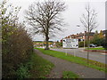
The postcode NG20 0BP occupies a compact residential cluster of 1,502 square metres in England. This specific location serves a population of 1,437 people, creating a tight-knit environment where local neighbours frequently know one another. Living in NG20 0BP means experiencing a setting defined by high person density rather than sprawling suburban estates. The area functions as a dedicated residential zone, prioritising quiet living and community interaction over commercial expansion. Daily life here revolves around local street networks and proximity to essential services rather than lengthy commutes to distant retail parks or entertainment districts. Prospective buyers should expect a settled community atmosphere where the character of the neighbourhood is shaped by long-term residents. This small footprint influences the pace of life, offering a sense of exclusivity and familiarity that larger towns often lack. The immediate surroundings are designed for domestic stability, making it suitable for those who value a defined home territory. Commuters and families seeking a contained living space will find the boundaries of NG20 0BP provide a clear sense of place without the isolation of rural living.
- Area Type
- Postcode
- Area Size
- 1502 m²
- Population
- 1437
- Population Density
- 3882 people/km²
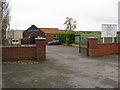
The property market in NG20 0BP is characterised by a predominance of owner-occupied housing. With 64% of residents owning their homes, this area functions less as a student rental hub and more as a settled residential community. The accommodation type is strictly houses, reflecting a housing stock designed for traditional family living rather than urban apartment lifestyles. Buyers looking specifically at NG20 0BP will find a market driven by established households rather than transient tenants. This high ownership percentage often correlates with steady house prices and a focus on long-term property maintenance. The scarcity of available rental properties suggests that investors looking for short-term letting opportunities may face limited inventory. Instead, the market caters to families seeking to purchase a permanent home base. Potential buyers should note that while the footprint is small, the nature of the houses available targets those with established needs who value permanence over the flexibility of the private rental sector. This structure supports a stable property value environment typical of mature, owner-led neighbourhoods.
House Prices in NG20 0BP
Showing 1 properties
| Address | Type | Beds | Baths | Last Sale Price | Last Sale Date | |
|---|---|---|---|---|---|---|
| Riverbank Medical Services, Warsop Primary Care Centre, Church Street, Warsop, NG20 0BP | commercial | - | - | - | - |
Energy Efficiency in NG20 0BP
Residents of NG20 0BP benefit from practical access to local retail and rail services within reasonable distance. Five notable retail venues are within practical reach, including the Lincolnshire Co-operative Co, Co-op Warsop, and the adjacent Co-op Warsop location. These cooperatives provide essential groceries and daily necessities, allowing shoppers to meet their needs without undertaking extensive travel. Transport links are equally convenient with five indicated rail points nearby, such as Shirebrook Railway Station, Langwith, and Mansfield Woodhouse Railway Station. These stations offer outward connections for commuters wishing to travel to wider employment hubs. The blend of cooperative retail provision and accessible rail stations defines the convenience factor for daily life. While the area itself is residential, the immediate vicinity offers the commercial support required for a self-sufficient lifestyle. Families and individuals can manage budgets and work schedules effectively by relying on these established transport and retail networks that sit just beyond the doorstep of NG20 0BP.
Amenities
Schools
Families in NG20 0BP have access to two primary educational institutions listed in the local vicinity. Hetts Lane Infant and Nursery School operates as a primary school and holds a 'good' Ofsted rating, offering parents assurance regarding educational quality in the early years. The second option is The Meden School and Technology College, which also serves as a primary institution within the immediate catchment reach. This mix of primary schools provides coverage for children from early education through to key stage two. While no secondary schools are explicitly listed in the provided data for this specific cluster, the presence of these two rated primary options indicates a functioning local education network. Parents planning to move here can rely on schools that have met the government's standard of 'good' performance. The availability of such infrastructure supports families entering the area with confidence, ensuring that early childhood education is secure just moments from the residential cluster.
| Rank | School | Type | Entry gender | Ages |
|---|
Explore more schools in this area
Go to Schools tabDemographics
The community in NG20 0BP reflects a mature household profile with a median age of 47 years. Most residents fall within the 30 to 64-year-old age range, indicating a demographic comprised primarily of adults establishing families or managing established careers. House ownership stands at a robust 64%, suggesting that the majority of households in this cluster have purchased their homes rather than renting. This high ownership rate contributes to long-term stability within the neighbourhood. The accommodation type is exclusively houses, meaning apartment living or converted flats are not present in this specific cluster. The predominant ethnic group is White, which aligns with the broader regional_average. With a population density reaching 956,792 people per square kilometre based on the provided figures, the area is tightly packed. This concentration creates an environment where space is at a premium but community bonds are often stronger. The demographic makeup points to a neighbourhood best suited for established adults rather than young professionals or students who might prefer younger, mixed-age housing clusters.
Household Size
Accommodation Type
Tenure
Ethnic Group
Religion
Household Composition
Age
Household Deprivation
NS-SEC
Explore more demographic insights in this area
Go to Demographics tabPlanning
Planning Constraints
- Flood RiskPremium
- Ramsar Wetland SitesPremium
- Area of Outstanding Natural BeautyPremium
- Protected Nature ReservePremium
- Protected WoodlandPremium