Area Overview for NG2 7ND
Photos of NG2 7ND
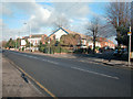

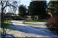
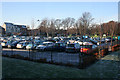
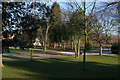
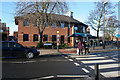


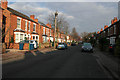
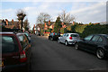
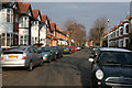
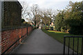
100 photos from this area
Area Information
Key information about the NG2 7ND including its size, population, and administrative classification.
- Area Type
- Postcode
- Area Size
- 1.2 hectares
- Population
- 1499
- Population Density
- 9025 people/km²
House Prices in NG2 7ND
45
Properties
£393,425
Average Sold Price
£91,200
Lowest Price
£790,000
Highest Price
Showing 45 properties
| Address | Type | Beds | Baths | Last Sale Price | Last Sale Date | |
|---|---|---|---|---|---|---|
| 83 Henry Road, West Bridgford, NG2 7ND | Semi-detached | 5 | 2 | £550,000 | Aug 2024 | |
| 73 Henry Road, West Bridgford, NG2 7ND | Semi-detached | 5 | 1 | £685,000 | Jan 2022 | |
| 67 Henry Road, West Bridgford, NG2 7ND | house | - | - | £790,000 | Jan 2022 | |
| 80 Henry Road, West Bridgford, NG2 7ND | house | - | - | £605,000 | Jun 2021 | |
| 69 Henry Road, West Bridgford, NG2 7ND | Semi-detached | 5 | 2 | £599,950 | Sep 2018 | |
| 64 Henry Road, West Bridgford, NG2 7ND | Semi-detached | 5 | - | £420,000 | Dec 2016 | |
| 87 Henry Road, West Bridgford, NG2 7ND | Semi-detached | 5 | 1 | £320,000 | Oct 2014 | |
| 76 Henry Road, West Bridgford, NG2 7ND | Semi-detached | 5 | 2 | £412,000 | Jul 2013 | |
| 57 Henry Road, West Bridgford, NG2 7ND | Semi-detached | 4 | 1 | £380,000 | Dec 2012 | |
| 72 Henry Road, West Bridgford, NG2 7ND | house | 5 | - | £300,000 | Jun 2011 |
Page 1 of 5
Energy Efficiency in NG2 7ND
Amenities
Schools
| Rank | School | Type | Entry gender | Ages |
|---|
Explore more schools in this area
Go to Schools tabDemographics
Household Size
One person
most common
Accommodation Type
Flats
most common
Tenure
39
majority
Ethnic Group
White
most common
Religion
N/A
most common
Household Composition
N/A
most common
Age
47
median
Adults (30-64 years)
most common
Household Deprivation
N/A
with no deprivation
NS-SEC
41
in Lower managerial occupations
Explore more demographic insights in this area
Go to Demographics tabPlanning
Planning Constraints
- Flood RiskPremium
- Ramsar Wetland SitesPremium
- Area of Outstanding Natural BeautyPremium
- Protected Nature ReservePremium
- Protected WoodlandPremium