Area Overview for NG2 7AD
Photos of NG2 7AD
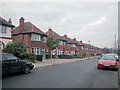
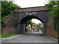
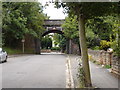
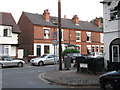
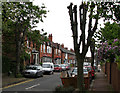
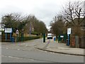
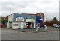
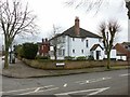
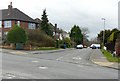
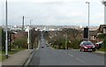
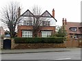
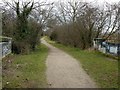
88 photos from this area
Area Information
Key information about the NG2 7AD including its size, population, and administrative classification.
- Area Type
- Postcode
- Area Size
- 9404 m²
- Population
- 1374
- Population Density
- 5900 people/km²
House Prices in NG2 7AD
26
Properties
£422,658
Average Sold Price
£130,000
Lowest Price
£695,000
Highest Price
Showing 26 properties
| Address | Type | Beds | Baths | Last Sale Price | Last Sale Date | |
|---|---|---|---|---|---|---|
| 100 Chaworth Road, West Bridgford, NG2 7AD | Detached | 5 | 2 | £667,500 | Jun 2025 | |
| 86 Chaworth Road, West Bridgford, NG2 7AD | Semi-detached | 5 | 2 | £580,000 | Jan 2024 | |
| 64 Chaworth Road, West Bridgford, NG2 7AD | Detached | 5 | 2 | £692,500 | Aug 2022 | |
| 56 Chaworth Road, West Bridgford, NG2 7AD | Retail | 5 | 2 | £695,000 | May 2022 | |
| 94 Chaworth Road, West Bridgford, NG2 7AD | house | - | - | £625,000 | Jun 2021 | |
| 80 Chaworth Road, West Bridgford, NG2 7AD | Semi-detached | 5 | 1 | £550,000 | Dec 2020 | |
| 90 Chaworth Road, West Bridgford, NG2 7AD | Detached | 5 | 2 | £590,000 | Oct 2019 | |
| 82 Chaworth Road, West Bridgford, NG2 7AD | Semi-detached | 5 | 1 | £440,000 | Jun 2018 | |
| 60 Chaworth Road, West Bridgford, NG2 7AD | Semi-detached | 4 | - | £330,000 | Jun 2012 | |
| 78 Chaworth Road, West Bridgford, NG2 7AD | house | 6 | 2 | £265,000 | Mar 2012 |
Page 1 of 3
Energy Efficiency in NG2 7AD
Amenities
Schools
| Rank | School | Type | Entry gender | Ages |
|---|
Explore more schools in this area
Go to Schools tabDemographics
Household Size
Family (3-5 people)
most common
Accommodation Type
Houses
most common
Tenure
70
majority
Ethnic Group
White
most common
Religion
N/A
most common
Household Composition
N/A
most common
Age
47
median
Adults (30-64 years)
most common
Household Deprivation
N/A
with no deprivation
NS-SEC
52
in Lower managerial occupations
Explore more demographic insights in this area
Go to Demographics tabPlanning
Planning Constraints
- Flood RiskPremium
- Ramsar Wetland SitesPremium
- Area of Outstanding Natural BeautyPremium
- Protected Nature ReservePremium
- Protected WoodlandPremium