Area Overview for NG2 6FP
Photos of NG2 6FP
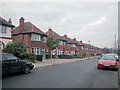
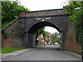
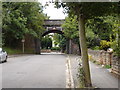
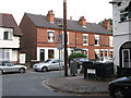
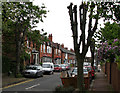
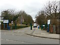
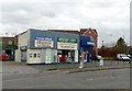
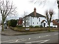
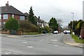
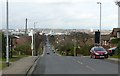
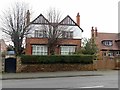
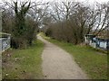
88 photos from this area
Area Information
Key information about the NG2 6FP including its size, population, and administrative classification.
- Area Type
- Postcode
- Area Size
- 1.6 hectares
- Population
- 1765
- Population Density
- 4237 people/km²
House Prices in NG2 6FP
33
Properties
£348,998
Average Sold Price
£85,000
Lowest Price
£690,000
Highest Price
Showing 33 properties
| Address | Type | Beds | Baths | Last Sale Price | Last Sale Date | |
|---|---|---|---|---|---|---|
| 11 Burleigh Road, West Bridgford, NG2 6FP | Detached | 4 | 1 | £645,000 | Sep 2025 | |
| 5 Burleigh Road, West Bridgford, NG2 6FP | Detached | 4 | 2 | £690,000 | Apr 2025 | |
| 29 Burleigh Road, West Bridgford, NG2 6FP | Semi-detached | 3 | 2 | £585,000 | Feb 2025 | |
| 1A Burleigh Road, West Bridgford, NG2 6FP | Detached | 4 | 2 | £473,000 | Sep 2024 | |
| 16 Burleigh Road, West Bridgford, NG2 6FP | Semi-detached | 5 | - | £518,000 | Oct 2018 | |
| 15 Burleigh Road, West Bridgford, NG2 6FP | Detached | 4 | 2 | £550,000 | May 2018 | |
| 13 Burleigh Road, West Bridgford, NG2 6FP | Detached | 3 | 1 | £472,000 | Jan 2017 | |
| 6 Burleigh Road, West Bridgford, NG2 6FP | house | - | - | £435,000 | May 2016 | |
| 12 Burleigh Road, West Bridgford, NG2 6FP | Semi-detached | 3 | 1 | £385,000 | Oct 2015 | |
| 2A Burleigh Road, West Bridgford, NG2 6FP | Detached | 3 | 1 | £350,000 | Oct 2013 |
Page 1 of 4
Energy Efficiency in NG2 6FP
Amenities
Schools
| Rank | School | Type | Entry gender | Ages |
|---|
Explore more schools in this area
Go to Schools tabDemographics
Household Size
Family (3-5 people)
most common
Accommodation Type
Houses
most common
Tenure
80
majority
Ethnic Group
White
most common
Religion
N/A
most common
Household Composition
N/A
most common
Age
47
median
Adults (30-64 years)
most common
Household Deprivation
N/A
with no deprivation
NS-SEC
59
in Lower managerial occupations
Explore more demographic insights in this area
Go to Demographics tabPlanning
Planning Constraints
- Flood RiskPremium
- Ramsar Wetland SitesPremium
- Area of Outstanding Natural BeautyPremium
- Protected Nature ReservePremium
- Protected WoodlandPremium