Area Overview for NG2 6DB
Photos of NG2 6DB
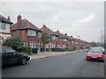
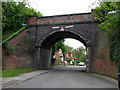
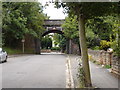
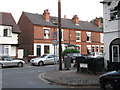
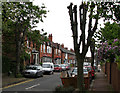
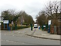
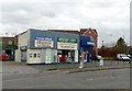
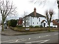
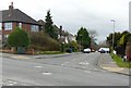
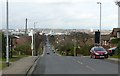
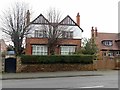
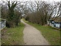
88 photos from this area
Area Information
Key information about the NG2 6DB including its size, population, and administrative classification.
- Area Type
- Postcode
- Area Size
- 6388 m²
- Population
- 1398
- Population Density
- 7524 people/km²
House Prices in NG2 6DB
14
Properties
£209,831
Average Sold Price
£62,000
Lowest Price
£337,000
Highest Price
Showing 14 properties
| Address | Type | Beds | Baths | Last Sale Price | Last Sale Date | |
|---|---|---|---|---|---|---|
| 132 Exchange Road, West Bridgford, NG2 6DB | Semi-detached | 2 | 1 | £337,000 | Aug 2025 | |
| 122 Exchange Road, West Bridgford, NG2 6DB | Terraced | 2 | 1 | £257,500 | Nov 2022 | |
| 142 Exchange Road, West Bridgford, NG2 6DB | Semi-detached | 3 | 1 | £325,000 | Feb 2022 | |
| 136 Exchange Road, West Bridgford, NG2 6DB | Semi-detached | 2 | 1 | £287,500 | Jun 2021 | |
| 126 Exchange Road, West Bridgford, NG2 6DB | Terraced | 2 | 1 | £213,500 | Mar 2021 | |
| 146 Exchange Road, West Bridgford, NG2 6DB | Semi-detached | 3 | 1 | £220,000 | Apr 2016 | |
| 124 Exchange Road, West Bridgford, NG2 6DB | Terraced | 2 | - | £172,500 | Jul 2014 | |
| 130 Exchange Road, West Bridgford, NG2 6DB | house | 3 | - | £207,500 | Apr 2011 | |
| 138 Exchange Road, West Bridgford, NG2 6DB | house | 3 | - | £185,000 | Apr 2010 | |
| 134 Exchange Road, West Bridgford, NG2 6DB | Semi-detached | 2 | 1 | £182,000 | Mar 2008 |
Page 1 of 2
Energy Efficiency in NG2 6DB
Amenities
Schools
| Rank | School | Type | Entry gender | Ages |
|---|
Explore more schools in this area
Go to Schools tabDemographics
Household Size
One person
most common
Accommodation Type
Houses
most common
Tenure
59
majority
Ethnic Group
White
most common
Religion
N/A
most common
Household Composition
N/A
most common
Age
47
median
Adults (30-64 years)
most common
Household Deprivation
N/A
with no deprivation
NS-SEC
52
in Lower managerial occupations
Explore more demographic insights in this area
Go to Demographics tabPlanning
Planning Constraints
- Flood RiskPremium
- Ramsar Wetland SitesPremium
- Area of Outstanding Natural BeautyPremium
- Protected Nature ReservePremium
- Protected WoodlandPremium