Area Overview for NG2 5JT
Photos of NG2 5JT
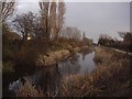
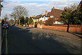
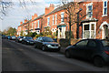
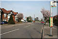
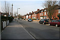
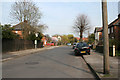
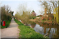
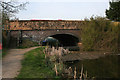
100 photos from this area
Area Information
Key information about the NG2 5JT including its size, population, and administrative classification.
- Area Type
- Postcode
- Area Size
- 1.0 hectares
- Population
- 1519
- Population Density
- 4738 people/km²
House Prices in NG2 5JT
29
Properties
£149,690
Average Sold Price
£59,950
Lowest Price
£330,000
Highest Price
Showing 29 properties
| Address | Type | Beds | Baths | Last Sale Price | Last Sale Date | |
|---|---|---|---|---|---|---|
| 64C Eltham Road, West Bridgford, NG2 5JT | Flat | - | - | £165,000 | Jan 2023 | |
| 98 Eltham Road, West Bridgford, NG2 5JT | Retail | 3 | 1 | £330,000 | Mar 2022 | |
| 66B Eltham Road, West Bridgford, NG2 5JT | Flat | 2 | 1 | £162,500 | Jan 2022 | |
| 84 Eltham Road, West Bridgford, NG2 5JT | house | - | - | £100,000 | Aug 2021 | |
| 64D Eltham Road, West Bridgford, NG2 5JT | Flat | - | - | £152,000 | May 2021 | |
| 64B Eltham Road, West Bridgford, NG2 5JT | Maisonette | 2 | 1 | £145,000 | Jul 2020 | |
| 72 Eltham Road, West Bridgford, NG2 5JT | Semi-detached | 3 | 1 | £260,000 | Nov 2017 | |
| 66C Eltham Road, West Bridgford, NG2 5JT | Flat | - | - | £139,950 | Jul 2017 | |
| 64A Eltham Road, West Bridgford, NG2 5JT | Flat | - | - | £122,000 | Aug 2015 | |
| 66A Eltham Road, West Bridgford, NG2 5JT | Flat | 2 | 1 | £113,000 | Feb 2013 |
Page 1 of 3
Energy Efficiency in NG2 5JT
Amenities
Schools
| Rank | School | Type | Entry gender | Ages |
|---|
Explore more schools in this area
Go to Schools tabDemographics
Household Size
Family (3-5 people)
most common
Accommodation Type
Houses
most common
Tenure
84
majority
Ethnic Group
White
most common
Religion
N/A
most common
Household Composition
N/A
most common
Age
47
median
Adults (30-64 years)
most common
Household Deprivation
N/A
with no deprivation
NS-SEC
60
in Lower managerial occupations
Explore more demographic insights in this area
Go to Demographics tabPlanning
Planning Constraints
- Flood RiskPremium
- Ramsar Wetland SitesPremium
- Area of Outstanding Natural BeautyPremium
- Protected Nature ReservePremium
- Protected WoodlandPremium