Area Overview for NG2 5GB
Photos of NG2 5GB
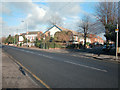
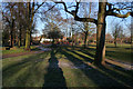
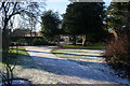
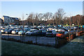
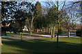
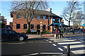
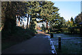
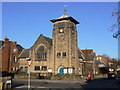
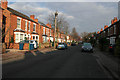
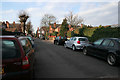
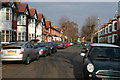
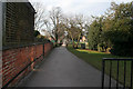
100 photos from this area
Area Information
Key information about the NG2 5GB including its size, population, and administrative classification.
- Area Type
- Postcode
- Area Size
- 4.1 hectares
- Population
- 1628
- Population Density
- 3202 people/km²
House Prices in NG2 5GB
56
Properties
£344,715
Average Sold Price
£42,000
Lowest Price
£740,000
Highest Price
Showing 56 properties
| Address | Type | Beds | Baths | Last Sale Price | Last Sale Date | |
|---|---|---|---|---|---|---|
| 36 Edward Road, West Bridgford, NG2 5GB | Detached | 4 | 2 | £620,000 | Feb 2025 | |
| 26 Edward Road, West Bridgford, NG2 5GB | Terraced | 3 | 1 | £314,500 | Jan 2025 | |
| 18 Edward Road, West Bridgford, NG2 5GB | Terraced | 3 | 1 | £410,000 | May 2024 | |
| 96 Edward Road, West Bridgford, NG2 5GB | Semi-detached | 5 | 2 | £595,000 | Dec 2023 | |
| 2 Edward Road, West Bridgford, NG2 5GB | Flat | 2 | 1 | £192,500 | Aug 2023 | |
| 30 Edward Road, West Bridgford, NG2 5GB | Terraced | 4 | 1 | £450,329 | Jul 2023 | |
| 6 Edward Road, West Bridgford, NG2 5GB | Semi-detached | 3 | 1 | £400,000 | Dec 2022 | |
| 82 Edward Road, West Bridgford, NG2 5GB | Detached | 4 | 2 | £740,000 | Dec 2022 | |
| 124 Edward Road, West Bridgford, NG2 5GB | Semi-detached | 4 | 1 | £540,000 | Nov 2022 | |
| 100 Edward Road, West Bridgford, NG2 5GB | house | 5 | 3 | £705,000 | May 2022 |
Page 1 of 6
Energy Efficiency in NG2 5GB
Amenities
Schools
| Rank | School | Type | Entry gender | Ages |
|---|
Explore more schools in this area
Go to Schools tabDemographics
Household Size
One person
most common
Accommodation Type
Flats
most common
Tenure
34
majority
Ethnic Group
White
most common
Religion
N/A
most common
Household Composition
N/A
most common
Age
22
median
Young Adults (15-29 years)
most common
Household Deprivation
N/A
with no deprivation
NS-SEC
39
in Lower managerial occupations
Explore more demographic insights in this area
Go to Demographics tabPlanning
Planning Constraints
- Flood RiskPremium
- Ramsar Wetland SitesPremium
- Area of Outstanding Natural BeautyPremium
- Protected Nature ReservePremium
- Protected WoodlandPremium