Area Overview for NG2 2HB
Photos of NG2 2HB
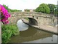
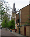
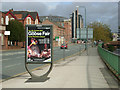
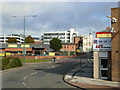
100 photos from this area
Area Information
Key information about the NG2 2HB including its size, population, and administrative classification.
- Area Type
- Postcode
- Area Size
- 8764 m²
- Population
- 1785
- Population Density
- 14560 people/km²
House Prices in NG2 2HB
22
Properties
£94,708
Average Sold Price
£22,500
Lowest Price
£173,000
Highest Price
Showing 22 properties
| Address | Type | Beds | Baths | Last Sale Price | Last Sale Date | |
|---|---|---|---|---|---|---|
| 40 Muskham Street, Nottingham, NG2 2HB | Semi-detached | 2 | 1 | £172,500 | Sep 2022 | |
| 46 Muskham Street, Nottingham, NG2 2HB | Terraced | 3 | 1 | £173,000 | Jan 2022 | |
| 44 Muskham Street, Nottingham, NG2 2HB | Terraced | 4 | 2 | £156,000 | May 2020 | |
| 5 Muskham Street, Nottingham, NG2 2HB | house | - | - | £130,000 | Sep 2019 | |
| 15 Muskham Street, Nottingham, NG2 2HB | house | - | - | £95,000 | Feb 2007 | |
| 48 Muskham Street, Nottingham, NG2 2HB | Terraced | 3 | 1 | £80,000 | Jun 2006 | |
| 9 Muskham Street, Nottingham, NG2 2HB | house | - | - | £87,000 | Apr 2006 | |
| 42 Muskham Street, Nottingham, NG2 2HB | house | 4 | - | £76,000 | Apr 2005 | |
| 32 Muskham Street, Nottingham, NG2 2HB | house | - | - | £80,000 | Jan 2005 | |
| 38 Muskham Street, Nottingham, NG2 2HB | Semi-detached | - | - | £35,500 | Mar 2002 |
Page 1 of 3
Energy Efficiency in NG2 2HB
Amenities
Schools
| Rank | School | Type | Entry gender | Ages |
|---|
Explore more schools in this area
Go to Schools tabDemographics
Household Size
Family (3-5 people)
most common
Accommodation Type
Houses
most common
Tenure
44
majority
Ethnic Group
White
most common
Religion
N/A
most common
Household Composition
N/A
most common
Age
22
median
Adults (30-64 years)
most common
Household Deprivation
N/A
with no deprivation
NS-SEC
25
in Lower managerial occupations
Explore more demographic insights in this area
Go to Demographics tabPlanning
Planning Constraints
- Flood RiskPremium
- Ramsar Wetland SitesPremium
- Area of Outstanding Natural BeautyPremium
- Protected Nature ReservePremium
- Protected WoodlandPremium