Area Overview for NG2 2EE
Photos of NG2 2EE
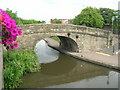
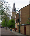

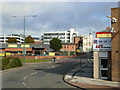
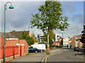
100 photos from this area
Area Information
Key information about the NG2 2EE including its size, population, and administrative classification.
- Area Type
- Postcode
- Area Size
- 1.2 hectares
- Population
- 1680
- Population Density
- 2428 people/km²
House Prices in NG2 2EE
34
Properties
£83,038
Average Sold Price
£20,500
Lowest Price
£171,000
Highest Price
Showing 34 properties
| Address | Type | Beds | Baths | Last Sale Price | Last Sale Date | |
|---|---|---|---|---|---|---|
| 104 Bathley Street, Nottingham, NG2 2EE | Terraced | 3 | 1 | £171,000 | May 2022 | |
| 148 Bathley Street, Nottingham, NG2 2EE | Semi-detached | 3 | 2 | £170,000 | Jan 2022 | |
| 106 Bathley Street, Nottingham, NG2 2EE | house | - | - | £135,000 | Aug 2020 | |
| 107 Bathley Street, Nottingham, NG2 2EE | Terraced | 2 | 1 | £121,000 | Dec 2017 | |
| 111 Bathley Street, Nottingham, NG2 2EE | Terraced | 2 | 1 | £75,500 | Jul 2014 | |
| 100 Bathley Street, Nottingham, NG2 2EE | Terraced | 3 | 1 | £58,500 | Sep 2011 | |
| 105 Bathley Street, Nottingham, NG2 2EE | Terraced | - | - | £45,000 | May 2007 | |
| 110 Bathley Street, Nottingham, NG2 2EE | house | 4 | 1 | £85,000 | Mar 2007 | |
| 101 Bathley Street, Nottingham, NG2 2EE | house | - | - | £35,000 | Mar 2004 | |
| 109 Bathley Street, Nottingham, NG2 2EE | house | - | - | £39,950 | Jul 2001 |
Page 1 of 4
Energy Efficiency in NG2 2EE
Amenities
Schools
| Rank | School | Type | Entry gender | Ages |
|---|
Explore more schools in this area
Go to Schools tabDemographics
Household Size
One person
most common
Accommodation Type
Houses
most common
Tenure
52
majority
Ethnic Group
White
most common
Religion
N/A
most common
Household Composition
N/A
most common
Age
47
median
Adults (30-64 years)
most common
Household Deprivation
N/A
with no deprivation
NS-SEC
38
in Lower managerial occupations
Explore more demographic insights in this area
Go to Demographics tabPlanning
Planning Constraints
- Flood RiskPremium
- Ramsar Wetland SitesPremium
- Area of Outstanding Natural BeautyPremium
- Protected Nature ReservePremium
- Protected WoodlandPremium