Area Overview for NG2 1RT
Photos of NG2 1RT
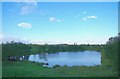
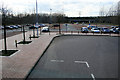
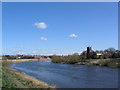
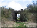
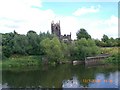

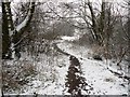
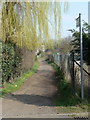
100 photos from this area
Area Information
Key information about the NG2 1RT including its size, population, and administrative classification.
- Area Type
- Postcode
- Area Size
- 3.6 hectares
- Population
- 2365
- Population Density
- 1400 people/km²
House Prices in NG2 1RT
8
Properties
-
Average Sold Price
-
Lowest Price
-
Highest Price
Showing 8 properties
| Address | Type | Beds | Baths | Last Sale Price | Last Sale Date | |
|---|---|---|---|---|---|---|
| Our Lady Of Lourdes Catholic Multi Academy Trust, First Floor Part, Loxley House, Tottle Road, Nottingham, NG2 1RT | Office | - | - | - | - | |
| Flat 2, Riverside Farm, Tottle Road, Nottingham, NG2 1RT | office_workshop | - | - | - | - | |
| Atos Medical Uk Ltd, First Floor, Cartwright House, Tottle Road, Nottingham, NG2 1RT | hospital_care_home | - | - | - | - | |
| Crawford, Ground Floor, Cartwright House, Tottle Road, Nottingham, NG2 1RT | office_workshop | - | - | - | - | |
| Towry Ltd, Part Ground Floor, Loxley House, Tottle Road, Nottingham, NG2 1RT | Office | - | - | - | - | |
| Flat 1, Riverside Farm, Tottle Road, Nottingham, NG2 1RT | Flat | - | - | - | - | |
| Riverside Farm, Tottle Road, Nottingham, NG2 1RT | Leisure | - | - | - | - | |
| Newmedica, Unit C, Tottle Road, Nottingham, NG2 1RT | Office | - | - | - | - |
Energy Efficiency in NG2 1RT
Amenities
Schools
| Rank | School | Type | Entry gender | Ages |
|---|
Explore more schools in this area
Go to Schools tabDemographics
Household Size
One person
most common
Accommodation Type
Flats
most common
Tenure
28
majority
Ethnic Group
White
most common
Religion
N/A
most common
Household Composition
N/A
most common
Age
47
median
Adults (30-64 years)
most common
Household Deprivation
N/A
with no deprivation
NS-SEC
27
in Lower managerial occupations
Explore more demographic insights in this area
Go to Demographics tabPlanning
Planning Constraints
- Flood RiskPremium
- Ramsar Wetland SitesPremium
- Area of Outstanding Natural BeautyPremium
- Protected Nature ReservePremium
- Protected WoodlandPremium