Area Overview for NG19 8SZ
Photos of NG19 8SZ
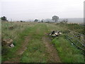
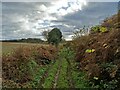
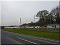
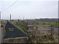
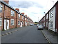
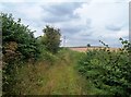
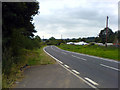
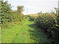

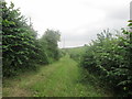
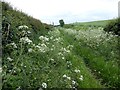
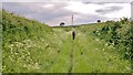
12 photos from this area
Area Information
Key information about the NG19 8SZ including its size, population, and administrative classification.
- Area Type
- Postcode
- Area Size
- 4.4 hectares
- Population
- 2590
- Population Density
- 354 people/km²
House Prices in NG19 8SZ
46
Properties
£63,329
Average Sold Price
£9,850
Lowest Price
£108,000
Highest Price
Showing 46 properties
| Address | Type | Beds | Baths | Last Sale Price | Last Sale Date | |
|---|---|---|---|---|---|---|
| 193 Portland Street, New Houghton, NG19 8SZ | Terraced | 2 | 1 | £85,000 | Dec 2024 | |
| 186 Portland Street, New Houghton, NG19 8SZ | Terraced | 3 | 1 | £84,000 | Oct 2024 | |
| 182 Portland Street, New Houghton, NG19 8SZ | Terraced | 3 | 1 | £108,000 | Jun 2024 | |
| 215 Portland Street, New Houghton, NG19 8SZ | Terraced | 2 | 1 | £105,000 | Jun 2024 | |
| 199 Portland Street, New Houghton, NG19 8SZ | Terraced | 3 | 1 | £94,000 | Apr 2024 | |
| 204 Portland Street, New Houghton, NG19 8SZ | house | - | - | £100,000 | Mar 2023 | |
| 203 Portland Street, New Houghton, NG19 8SZ | Terraced | 3 | 1 | £98,000 | Nov 2022 | |
| 179 Portland Street, New Houghton, NG19 8SZ | house | 2 | 1 | £90,000 | May 2022 | |
| 174 Portland Street, New Houghton, NG19 8SZ | Terraced | 2 | 1 | £70,000 | Dec 2021 | |
| 192 Portland Street, New Houghton, NG19 8SZ | house | - | - | £92,000 | Nov 2021 |
Page 1 of 5
Energy Efficiency in NG19 8SZ
Amenities
Schools
| Rank | School | Type | Entry gender | Ages |
|---|
Explore more schools in this area
Go to Schools tabDemographics
Household Size
Two person
most common
Accommodation Type
Houses
most common
Tenure
75
majority
Ethnic Group
White
most common
Religion
N/A
most common
Household Composition
N/A
most common
Age
47
median
Adults (30-64 years)
most common
Household Deprivation
N/A
with no deprivation
NS-SEC
24
in Lower managerial occupations
Explore more demographic insights in this area
Go to Demographics tabPlanning
Planning Constraints
- Flood RiskPremium
- Ramsar Wetland SitesPremium
- Area of Outstanding Natural BeautyPremium
- Protected Nature ReservePremium
- Protected WoodlandPremium