Area Overview for NG19 8JU
Photos of NG19 8JU
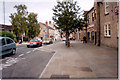


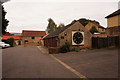
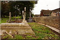

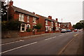
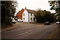
48 photos from this area
Area Information
Key information about the NG19 8JU including its size, population, and administrative classification.
- Area Type
- Postcode
- Area Size
- 3.0 hectares
- Population
- 1656
- Population Density
- 4723 people/km²
House Prices in NG19 8JU
36
Properties
£151,213
Average Sold Price
£30,000
Lowest Price
£370,000
Highest Price
Showing 36 properties
| Address | Type | Beds | Baths | Last Sale Price | Last Sale Date | |
|---|---|---|---|---|---|---|
| 87 Ley Lane, Mansfield Woodhouse, NG19 8JU | Semi-detached | 3 | 1 | £206,000 | May 2023 | |
| 31 Ley Lane, Mansfield Woodhouse, NG19 8JU | Bungalow | - | - | £205,000 | Nov 2022 | |
| 49 Ley Lane, Mansfield Woodhouse, NG19 8JU | Bungalow | - | - | £200,000 | Mar 2022 | |
| 93 Ley Lane, Mansfield Woodhouse, NG19 8JU | house | - | - | £180,000 | Sep 2021 | |
| 97 Ley Lane, Mansfield Woodhouse, NG19 8JU | Semi-detached | 3 | - | £166,000 | Nov 2020 | |
| 39 Ley Lane, Mansfield Woodhouse, NG19 8JU | Bungalow | 2 | 1 | £195,000 | Jul 2020 | |
| 85 Ley Lane, Mansfield Woodhouse, NG19 8JU | Semi-detached | 3 | 2 | £159,950 | Feb 2020 | |
| 103 Ley Lane, Mansfield Woodhouse, NG19 8JU | Detached | 5 | 2 | £370,000 | Sep 2019 | |
| 51 Ley Lane, Mansfield Woodhouse, NG19 8JU | Bungalow | - | - | £230,000 | Aug 2019 | |
| 91 Ley Lane, Mansfield Woodhouse, NG19 8JU | Semi-detached | 3 | 1 | £163,000 | Jul 2018 |
Page 1 of 4
Energy Efficiency in NG19 8JU
Amenities
Schools
| Rank | School | Type | Entry gender | Ages |
|---|
Explore more schools in this area
Go to Schools tabDemographics
Household Size
Two person
most common
Accommodation Type
Houses
most common
Tenure
90
majority
Ethnic Group
White
most common
Religion
N/A
most common
Household Composition
N/A
most common
Age
47
median
Adults (30-64 years)
most common
Household Deprivation
N/A
with no deprivation
NS-SEC
28
in Lower managerial occupations
Explore more demographic insights in this area
Go to Demographics tabPlanning
Planning Constraints
- Flood RiskPremium
- Ramsar Wetland SitesPremium
- Area of Outstanding Natural BeautyPremium
- Protected Nature ReservePremium
- Protected WoodlandPremium