Area Overview for NG19 7QT
Photos of NG19 7QT

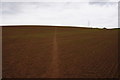
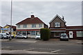
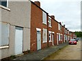

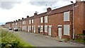
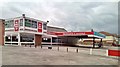
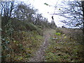
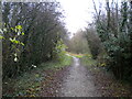
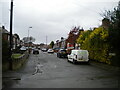
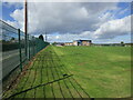
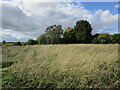
20 photos from this area
Area Information
Key information about the NG19 7QT including its size, population, and administrative classification.
- Area Type
- Postcode
- Area Size
- 1.5 hectares
- Population
- 2639
- Population Density
- 503 people/km²
House Prices in NG19 7QT
27
Properties
£130,000
Average Sold Price
£39,000
Lowest Price
£290,000
Highest Price
Showing 27 properties
| Address | Type | Beds | Baths | Last Sale Price | Last Sale Date | |
|---|---|---|---|---|---|---|
| 242 Chesterfield Road North, Pleasley, NG19 7QT | Bungalow | 2 | 1 | £290,000 | Mar 2025 | |
| 262 Chesterfield Road North, Pleasley, NG19 7QT | Detached | 3 | 1 | £250,000 | Aug 2023 | |
| 284 Chesterfield Road North, Pleasley, NG19 7QT | house | - | - | £108,000 | Apr 2021 | |
| 278 Chesterfield Road North, Pleasley, NG19 7QT | Semi-detached | 3 | 1 | £130,000 | Feb 2021 | |
| 282 Chesterfield Road North, Pleasley, NG19 7QT | Semi-detached | 3 | 1 | £135,000 | Apr 2020 | |
| 266 Chesterfield Road North, Pleasley, NG19 7QT | Semi-detached | 3 | - | £90,000 | Feb 2020 | |
| 290 Chesterfield Road North, Pleasley, NG19 7QT | Semi-detached | 3 | 1 | £145,000 | Dec 2019 | |
| 264 Chesterfield Road North, Pleasley, NG19 7QT | Semi-detached | 3 | 1 | £120,000 | Jun 2018 | |
| 286 Chesterfield Road North, Pleasley, NG19 7QT | Semi-detached | 3 | - | £112,000 | Feb 2016 | |
| 274 Chesterfield Road North, Pleasley, NG19 7QT | Semi-detached | - | - | £92,000 | Feb 2008 |
Page 1 of 3
Energy Efficiency in NG19 7QT
Amenities
Schools
| Rank | School | Type | Entry gender | Ages |
|---|
Explore more schools in this area
Go to Schools tabDemographics
Household Size
Two person
most common
Accommodation Type
Houses
most common
Tenure
63
majority
Ethnic Group
White
most common
Religion
N/A
most common
Household Composition
N/A
most common
Age
47
median
Adults (30-64 years)
most common
Household Deprivation
N/A
with no deprivation
NS-SEC
23
in Lower managerial occupations
Explore more demographic insights in this area
Go to Demographics tabPlanning
Planning Constraints
- Flood RiskPremium
- Ramsar Wetland SitesPremium
- Area of Outstanding Natural BeautyPremium
- Protected Nature ReservePremium
- Protected WoodlandPremium