Area Overview for NG19 7JD
Photos of NG19 7JD
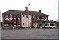
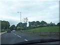

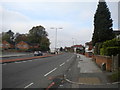
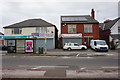
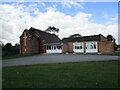
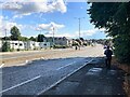

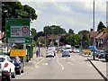
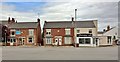
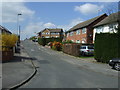

13 photos from this area
Area Information
Key information about the NG19 7JD including its size, population, and administrative classification.
- Area Type
- Postcode
- Area Size
- 2.6 hectares
- Population
- 2639
- Population Density
- 503 people/km²
House Prices in NG19 7JD
29
Properties
£122,875
Average Sold Price
£30,000
Lowest Price
£200,000
Highest Price
Showing 29 properties
| Address | Type | Beds | Baths | Last Sale Price | Last Sale Date | |
|---|---|---|---|---|---|---|
| 190 Chesterfield Road North, Mansfield, NG19 7JD | Bungalow | 2 | 2 | £190,750 | Dec 2023 | |
| 130 Chesterfield Road North, Mansfield, NG19 7JD | Bungalow | 3 | 2 | £200,000 | Dec 2022 | |
| 186 Chesterfield Road North, Mansfield, NG19 7JD | house | - | - | £120,000 | Aug 2019 | |
| 196 Chesterfield Road North, Mansfield, NG19 7JD | Bungalow | - | - | £105,000 | Nov 2018 | |
| 144 Chesterfield Road North, Mansfield, NG19 7JD | Bungalow | 2 | 1 | £120,000 | Oct 2015 | |
| 146 Chesterfield Road North, Mansfield, NG19 7JD | Detached | - | - | £125,000 | Oct 2015 | |
| 120 Chesterfield Road North, Mansfield, NG19 7JD | Semi-detached | 3 | 1 | £133,000 | Jul 2005 | |
| 118 Chesterfield Road North, Mansfield, NG19 7JD | house | - | - | £125,000 | Feb 2005 | |
| 198 Chesterfield Road North, Mansfield, NG19 7JD | Detached | - | - | £80,000 | Aug 2002 | |
| 116A Chesterfield Road North, Mansfield, NG19 7JD | Flat | - | - | £30,000 | Nov 1998 |
Page 1 of 3
Energy Efficiency in NG19 7JD
Amenities
Schools
| Rank | School | Type | Entry gender | Ages |
|---|
Explore more schools in this area
Go to Schools tabDemographics
Household Size
Two person
most common
Accommodation Type
Houses
most common
Tenure
63
majority
Ethnic Group
White
most common
Religion
N/A
most common
Household Composition
N/A
most common
Age
47
median
Adults (30-64 years)
most common
Household Deprivation
N/A
with no deprivation
NS-SEC
23
in Lower managerial occupations
Explore more demographic insights in this area
Go to Demographics tabPlanning
Planning Constraints
- Flood RiskPremium
- Ramsar Wetland SitesPremium
- Area of Outstanding Natural BeautyPremium
- Protected Nature ReservePremium
- Protected WoodlandPremium