Area Overview for NG19 7GD
Photos of NG19 7GD

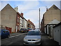


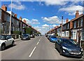
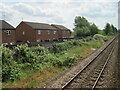
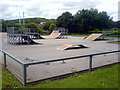
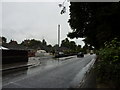
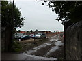
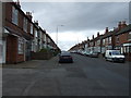

23 photos from this area
Area Information
Key information about the NG19 7GD including its size, population, and administrative classification.
- Area Type
- Postcode
- Area Size
- 2.6 hectares
- Population
- 2253
- Population Density
- 1752 people/km²
House Prices in NG19 7GD
60
Properties
£162,189
Average Sold Price
£96,950
Lowest Price
£295,000
Highest Price
Showing 60 properties
| Address | Type | Beds | Baths | Last Sale Price | Last Sale Date | |
|---|---|---|---|---|---|---|
| 57 Dunsil Road, Mansfield Woodhouse, NG19 7GD | Detached | 4 | 2 | £255,000 | Feb 2025 | |
| 43 Dunsil Road, Mansfield Woodhouse, NG19 7GD | Detached | 4 | 2 | £280,000 | Dec 2024 | |
| 18 Dunsil Road, Mansfield Woodhouse, NG19 7GD | Terraced | 4 | 2 | £182,800 | Jul 2024 | |
| 45 Dunsil Road, Mansfield Woodhouse, NG19 7GD | Detached | 4 | 2 | £258,000 | Jul 2024 | |
| 59 Dunsil Road, Mansfield Woodhouse, NG19 7GD | Detached | 4 | 2 | £192,000 | Jun 2024 | |
| 33 Dunsil Road, Mansfield Woodhouse, NG19 7GD | Detached | 4 | 2 | £271,500 | Apr 2024 | |
| 20 Dunsil Road, Mansfield Woodhouse, NG19 7GD | Terraced | 3 | 2 | £165,000 | Nov 2023 | |
| 53 Dunsil Road, Mansfield Woodhouse, NG19 7GD | Detached | 5 | 3 | £270,000 | Oct 2023 | |
| 27A Dunsil Road, Mansfield Woodhouse, NG19 7GD | Semi-detached | 3 | 1 | £155,000 | Jun 2023 | |
| 29 Dunsil Road, Mansfield Woodhouse, NG19 7GD | Detached | 1 | 3 | £295,000 | Mar 2023 |
Page 1 of 6
Energy Efficiency in NG19 7GD
Amenities
Schools
| Rank | School | Type | Entry gender | Ages |
|---|
Explore more schools in this area
Go to Schools tabDemographics
Household Size
Two person
most common
Accommodation Type
Houses
most common
Tenure
77
majority
Ethnic Group
White
most common
Religion
N/A
most common
Household Composition
N/A
most common
Age
47
median
Adults (30-64 years)
most common
Household Deprivation
N/A
with no deprivation
NS-SEC
31
in Lower managerial occupations
Explore more demographic insights in this area
Go to Demographics tabPlanning
Planning Constraints
- Flood RiskPremium
- Ramsar Wetland SitesPremium
- Area of Outstanding Natural BeautyPremium
- Protected Nature ReservePremium
- Protected WoodlandPremium