Area Overview for NG19 6SB
Photos of NG19 6SB
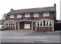
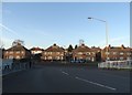
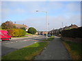
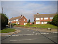
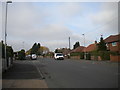
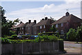
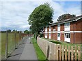
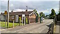
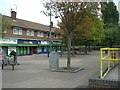
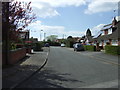
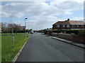
11 photos from this area
Area Information
Key information about the NG19 6SB including its size, population, and administrative classification.
- Area Type
- Postcode
- Area Size
- 4740 m²
- Population
- 1367
- Population Density
- 4003 people/km²
House Prices in NG19 6SB
23
Properties
£101,995
Average Sold Price
£11,200
Lowest Price
£247,000
Highest Price
Showing 23 properties
| Address | Type | Beds | Baths | Last Sale Price | Last Sale Date | |
|---|---|---|---|---|---|---|
| 100 George Street, Mansfield, NG19 6SB | house | - | - | £135,000 | Jul 2025 | |
| 98 George Street, Mansfield, NG19 6SB | Terraced | 2 | 1 | £100,500 | Apr 2025 | |
| 90 George Street, Mansfield, NG19 6SB | Terraced | 3 | 1 | £125,000 | Feb 2025 | |
| 110A George Street, Mansfield, NG19 6SB | Detached | 3 | 1 | £113,000 | Nov 2024 | |
| 112 George Street, Mansfield, NG19 6SB | Detached | 4 | 3 | £247,000 | Jul 2023 | |
| 92 George Street, Mansfield, NG19 6SB | Terraced | 2 | 1 | £100,000 | Feb 2023 | |
| 108 George Street, Mansfield, NG19 6SB | Terraced | 2 | 1 | £99,995 | Oct 2022 | |
| 96 George Street, Mansfield, NG19 6SB | Terraced | 2 | 1 | £69,500 | Mar 2020 | |
| 104 George Street, Mansfield, NG19 6SB | house | 2 | - | £74,000 | Nov 2010 | |
| 102 George Street, Mansfield, NG19 6SB | house | - | - | £46,750 | May 2009 |
Page 1 of 3
Energy Efficiency in NG19 6SB
Amenities
Schools
| Rank | School | Type | Entry gender | Ages |
|---|
Explore more schools in this area
Go to Schools tabDemographics
Household Size
One person
most common
Accommodation Type
Houses
most common
Tenure
44
majority
Ethnic Group
White
most common
Religion
N/A
most common
Household Composition
N/A
most common
Age
47
median
Adults (30-64 years)
most common
Household Deprivation
N/A
with no deprivation
NS-SEC
15
in Lower managerial occupations
Explore more demographic insights in this area
Go to Demographics tabPlanning
Planning Constraints
- Flood RiskPremium
- Ramsar Wetland SitesPremium
- Area of Outstanding Natural BeautyPremium
- Protected Nature ReservePremium
- Protected WoodlandPremium