Area Overview for NG18 5HL
Photos of NG18 5HL
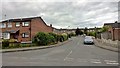

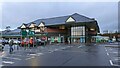
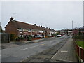
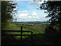
24 photos from this area
Area Information
Key information about the NG18 5HL including its size, population, and administrative classification.
- Area Type
- Postcode
- Area Size
- 4.7 hectares
- Population
- 1667
- Population Density
- 3557 people/km²
House Prices in NG18 5HL
22
Properties
£157,422
Average Sold Price
£33,750
Lowest Price
£300,000
Highest Price
Showing 22 properties
| Address | Type | Beds | Baths | Last Sale Price | Last Sale Date | |
|---|---|---|---|---|---|---|
| 218 Sutton Road, Mansfield, NG18 5HL | Detached | 3 | 2 | £300,000 | Nov 2024 | |
| 200 Sutton Road, Mansfield, NG18 5HL | Semi-detached | 3 | 1 | £205,000 | Nov 2021 | |
| 194 Sutton Road, Mansfield, NG18 5HL | Detached | 4 | 2 | £249,000 | Nov 2021 | |
| 208 Sutton Road, Mansfield, NG18 5HL | house | - | - | £160,000 | Apr 2021 | |
| 224 Sutton Road, Mansfield, NG18 5HL | house | - | - | £176,000 | Apr 2021 | |
| 198 Sutton Road, Mansfield, NG18 5HL | house | 3 | 1 | £153,500 | Dec 2020 | |
| 216 Sutton Road, Mansfield, NG18 5HL | Detached | 3 | 1 | £215,000 | Jan 2020 | |
| 210 Sutton Road, Mansfield, NG18 5HL | Semi-detached | 3 | 1 | £135,000 | Oct 2019 | |
| 220 Sutton Road, Mansfield, NG18 5HL | Detached | 3 | 1 | £200,000 | Sep 2018 | |
| 222 Sutton Road, Mansfield, NG18 5HL | Detached | 3 | - | £134,000 | Sep 2013 |
Page 1 of 3
Energy Efficiency in NG18 5HL
Amenities
Schools
| Rank | School | Type | Entry gender | Ages |
|---|
Explore more schools in this area
Go to Schools tabDemographics
Household Size
Two person
most common
Accommodation Type
Houses
most common
Tenure
86
majority
Ethnic Group
White
most common
Religion
N/A
most common
Household Composition
N/A
most common
Age
47
median
Adults (30-64 years)
most common
Household Deprivation
N/A
with no deprivation
NS-SEC
33
in Lower managerial occupations
Explore more demographic insights in this area
Go to Demographics tabPlanning
Planning Constraints
- Flood RiskPremium
- Ramsar Wetland SitesPremium
- Area of Outstanding Natural BeautyPremium
- Protected Nature ReservePremium
- Protected WoodlandPremium