Area Overview for NG18 4GT
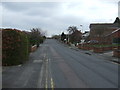
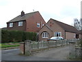
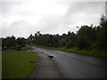
Photos of NG18 4GT


Area Information
Living in NG18 4GT means settling into a specific residential cluster defined by a population of 1,831 residents. This small postcode area sits within England and features a population density of 632 people per square kilometre. You are moving into a space that is residential in nature, avoiding the sprawl often found near major transport hubs while retaining access to key services. Daily life here revolves around a compact community where neighbours are likely to know one another within the year. The area functions as a sleep-out post for those working in nearby towns, offering a quiet environment for evening relaxation but requiring a commute for employment. Prospective buyers should understand that this is not a large estate but a concentrated group of dwellings. You will find yourself part of a specific micro-community rather than a sprawling neighbourhood. The density means amenities are relatively close, yet the scale remains intimate. This location offers a straightforward property search without the complexity of large developments. Residents benefit from proximity to schools and rail links without the noise and congestion of more central locations. The character of NG18 4GT is defined by its residential focus and manageable size. It serves as a practical base for locals seeking a distinct address away from the busiest streets of Mansfield or Woodhouse.
- Area Type
- Postcode
- Area Size
- Not available
- Population
- 1831
- Population Density
- 632 people/km²
The housing stock in NG18 4GT is characterised entirely by houses. This single type of accommodation defines the physical character of the residential cluster. With a home ownership rate of just 30%, the area functions significantly as a rental market. Most residents do not own their property outright, which typically affects price stability and landlord-tenant interactions within the local housing market. Buyers looking for a family home will find the inventory consists of standalone houses rather than flats or blocks of flats. This configuration suits families seeking private gardens and separate entrances. The low proportion of owner-occupiers means aggressive price wars are less common than in hot seller's markets. Instead, you will encounter a steady turnover of tenancies and rentals. This structure benefits long-term residents who value continuity over rapid capital appreciation. However, it also means potential buyers must navigate standard conveyancing and tenancy agreements if purchasing from a previous owner. The market reflects a practical approach to housing needs without the volatility of high-demand areas. For those seeking a place to live rather than an asset to flip, the current stock aligns well. The focus remains on utility and family space within a house format.
House Prices in NG18 4GT
No properties found in this postcode.
Energy Efficiency in NG18 4GT
Residents of NG18 4GT benefit from a range of retail and transport amenities within practical reach. Five main retail outlets are accessible, including Aldi Southwell, Tesco Mansfield, and Farmfoods Oak. These shops cater to daily needs such as groceries, household essentials, and basic foods without the need for a long drive. The retail landscape offers convenience for busy families who want to pick up essentials quickly after school or work. Alongside shopping, rail connectivity links the area to three key stations: Mansfield Railway Station, Mansfield Woodhouse Railway Station, and Sutton Parkway Railway Station. Access to these nodes facilitates travel to Nottingham, Sheffield, and other regional hubs. Commuters can reach these stations with minimal extra travel time, making the daily commute manageable. The combination of local shops and rail links creates a balanced lifestyle where you can manage your week without excessive travelling. Dining and leisure options appear limited to these specific named venues and the general area, focusing on utility rather than luxury entertainment. Shopping trips are efficient because the three major stores cover most categories of consumer goods. The rail options allow you to expand your job search or leisure travel beyond the immediate parish. This mix ensures that living in NG18 4GT does not sacrifice access to the broader economy.
Amenities
Schools
Families living in NG18 4GT have several primary schools nearby to consider for their children's education. St Peter's CofE First School operates as a primary institution serving the local community. Similarly, St Peter's CofE Primary School provides education for the younger age groups in the immediate vicinity. For families seeking a school with a good Ofsted rating, St Peter's CofE Primary Academy in Mansfield stands out with its specific classification. This academy offers a proven track record of educational quality within the county. The presence of multiple schools provides options for catchment-based enrolment or choice if moving boundaries allow. All listed institutions are primary schools, indicating that secondary education options lie further from this specific postcode. This concentration of primary provision suggests strong support for younger children living on NG18 4GT. Parents may choose between the Church of England faith-based options or the academy structure depending on their educational philosophy. The availability of three distinct primary schools ensures that residents have multiple pathways for compulsory education. School transport arrangements will depend on individual catchment maps, but the proximity of these three venues is a clear advantage for local families.
| Rank | School | Type | Entry gender | Ages |
|---|
Explore more schools in this area
Go to Schools tabDemographics
The community in NG18 4GT is dominated by adults between the ages of 30 and 64 years. This age range represents the most common demographic for residents in the postcode area. The median age for the population is 47 years, indicating a settled neighbourhood where families have established roots. Only 30% of residents own their homes, meaning the majority live in rented accommodation or through other tenure arrangements. Houses constitute the primary accommodation type, shaping the streetscape away from high-rise blocks or bungalows. The predominant ethnic group within this cluster is White. This demographic profile suggests a stable cohort of homeowners and renters who have chosen this specific location for its proximity to work and schools. There are few statistics on deprivation or disposable income, but the age and tenure data point toward a mix of young families and mature couples. The concentration of households in the 30-to-64 band implies a need for practical family-sized homes rather than student halls or elderly care facilities. Homeownership rates remain lower than national averages, which influences the market dynamics for sales in this area. Residents here are likely practical users of their space, prioritising location and connectivity over speculative investment.
Household Size
Accommodation Type
Tenure
Ethnic Group
Religion
Household Composition
Age
Household Deprivation
NS-SEC
Explore more demographic insights in this area
Go to Demographics tabPlanning
Planning Constraints
- Flood RiskPremium
- Ramsar Wetland SitesPremium
- Area of Outstanding Natural BeautyPremium
- Protected Nature ReservePremium
- Protected WoodlandPremium