Area Overview for NG18 4FL
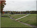
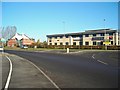
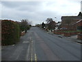
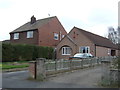
Photos of NG18 4FL


Area Information
Living in NG18 4FL means residing in a specific residential cluster defined by postcode NG18 4FL. This small area forms part of the broader Nottinghamshire landscape, serving a population of 1831 individuals. With a population density of 632 people per square kilometre, the location offers a compact living environment where neighbours are likely nearby. The area consists primarily of houses, creating a distinct character different from high-rise developments found in other parts of England. Daily life here revolves around a community that has remained relatively stable in size, offering a sense of settled neighbourhood life rather than the rapid expansion seen in larger urban zones. Prospective buyers looking at NG18 4FL will find a location that balances residential quiet with practical access to surrounding towns. The area functions as a sleep-out point for those working in nearby employment hubs, relying on transport links rather than local employment density. You will find yourself in a setting where housing is the dominant feature, supported by a network of local amenities designed to serve a few thousand residents. The postcode area covers a small footprint, meaning distances to services are generally short, reducing the need for long commutes within the immediate vicinity.
- Area Type
- Postcode
- Area Size
- Not available
- Population
- 1831
- Population Density
- 632 people/km²
The property market in NG18 4FL is defined by a specific housing stock that consists almost entirely of houses. This accommodation type choice shapes the market for anyone looking at homes in NG18 4FL, as buyers cannot expect to find flats or terraced units as the primary option. With 30 per cent of residents owning their homes, the area presents a mixed ownership landscape where rental dwellings outnumber owner-occupied properties. This balance is typical of a residential cluster serving commuters who may not yet own property or are in rental accommodations due to cost or flexibility needs. For buyers considering the immediate surroundings of NG18 4FL, the prevalence of houses suggests a suburban or semi-rural feel rather than an urban high-density zone. The low home ownership rate does not necessarily indicate a failing market but rather reflects the current stage of the lifecycle for the 1831 residents in this cluster. Investors or first-time buyers should note that the demand for rental properties is significant given that seven out of ten households are renting. The market status here is practical and functional, catering to those who prioritise house-based living over apartment living in this specific postcode sector.
House Prices in NG18 4FL
Showing 2 properties
| Address | Type | Beds | Baths | Last Sale Price | Last Sale Date | |
|---|---|---|---|---|---|---|
| W & J Linney Limited, Linney Create, Linney Group Limited, Adamsway, Mansfield, NG18 4FL | Office | - | - | - | - | |
| W & J Linney Limited, Activate, Linney Group Limited, Adamsway, Mansfield, NG18 4FL | warehouse | - | - | - | - |
Energy Efficiency in NG18 4FL
Residents of NG18 4FL enjoy convenient access to retail outlets and transport hubs within practical reach. The local retail scene includes Aldi Southwell, which offers essential grocery shopping. Tesco Mansfield provides another supermarket option for household needs. Farmfoods Oak serves those looking for discount grocery provisions. These three major retailers ensure that daily shopping requirements are met without the need for long journeys to overcrowded town centres. Five retail locations in this radius provide a comfortable supply chain for homes in NG18 4FL. Transport convenience is enhanced by five nearby railway stations that facilitate travel outside the immediate area. Mansfield Railway Station is the closest point on the rail network for most residents. Mansfield Woodhouse Railway Station and Sutton Parkway Railway Station act as secondary access points for broader regional connectivity. Residents can manage daily commutes or occasional trips to leisure destinations with ease. The proximity of these stations means you do not always need a car for short regional trips, though the area\'s size implies most daily activities are best conducted by car or on foot given the residential nature of the postcode.
Amenities
Schools
Families residing in or near NG18 4FL have access to three primary schools located within practical reach. St Peter's CofE First School serves the younger demographic at the primary level. St Peter's CofE Primary School provides education for children of similar ages. Further afield, St Peter's CofE Primary Academy, Mansfield, offers primary education and holds an Ofsted rating of good. This specific rating confirms a standard above the basic requirement, providing parents with a verified benchmark for educational quality in the immediate vicinity. The combination of multiple primary schools ensures that children do not necessarily have to travel long distances to attend suitable institutions. These educational facilities form a cohesive network supporting families who choose to live in NG18 4FL for its domestic attributes. Because Mansfield is referenced in the academy name, connections to that town\'s educational framework are evident. Parents looking at schools near NG18 4FL will find a selection of Church of England academies, indicating a strong religious affiliation within the local education sector. Each institution focuses on primary education, meaning secondary school choices would require looking beyond these immediate listings.
| Rank | School | Type | Entry gender | Ages |
|---|
Explore more schools in this area
Go to Schools tabDemographics
The community within NG18 4FL reflects an established settlement with a median age of 47 years. The most common age group comprises adults between 30 and 64 years, indicating a population of working age yet approaching retirement. This demographic profile suggests a neighbourhood dominated by families and individuals who have settled rather than transient renters or very young families. While specific household income data is not available, the age structure implies a need for housing suited to mature adults and potentially young families entering that bracket. Home ownership stands at 30 per cent, meaning the remaining 70 per cent of households are likely renting. This high rental proportion indicates a dynamic market where tenancy changes occur regularly. The predominant ethnic group in this area is White, forming the backbone of the local community. Accommodation types are exclusively houses, a fact confirmed by the demographic data provided for this specific postcode. This housing stock appeals to those seeking standalone properties rather than flats or apartments, aligning with the preference of the 30-64 age demographic.
Household Size
Accommodation Type
Tenure
Ethnic Group
Religion
Household Composition
Age
Household Deprivation
NS-SEC
Explore more demographic insights in this area
Go to Demographics tabPlanning
Planning Constraints
- Flood RiskPremium
- Ramsar Wetland SitesPremium
- Area of Outstanding Natural BeautyPremium
- Protected Nature ReservePremium
- Protected WoodlandPremium