Area Overview for NG18 4DF
Photos of NG18 4DF
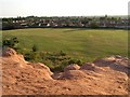
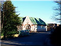
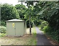
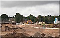

32 photos from this area
Area Information
Key information about the NG18 4DF including its size, population, and administrative classification.
- Area Type
- Postcode
- Area Size
- 4.4 hectares
- Population
- 1191
- Population Density
- 2463 people/km²
House Prices in NG18 4DF
51
Properties
£192,188
Average Sold Price
£49,000
Lowest Price
£375,000
Highest Price
Showing 51 properties
| Address | Type | Beds | Baths | Last Sale Price | Last Sale Date | |
|---|---|---|---|---|---|---|
| 58 Delamere Drive, Mansfield, NG18 4DF | house | - | - | £372,000 | Aug 2025 | |
| 46 Delamere Drive, Mansfield, NG18 4DF | Detached | 5 | 2 | £375,000 | Dec 2024 | |
| 44 Delamere Drive, Mansfield, NG18 4DF | house | 4 | 2 | £332,000 | Aug 2023 | |
| 60 Delamere Drive, Mansfield, NG18 4DF | Retail | 3 | 1 | £305,000 | May 2022 | |
| 56 Delamere Drive, Mansfield, NG18 4DF | Detached | 3 | 1 | £266,250 | Oct 2020 | |
| 65 Delamere Drive, Mansfield, NG18 4DF | Detached | 3 | 1 | £182,000 | Jun 2019 | |
| 74 Delamere Drive, Mansfield, NG18 4DF | Detached | 3 | 2 | £240,000 | Nov 2018 | |
| 67 Delamere Drive, Mansfield, NG18 4DF | Detached | 3 | 1 | £165,000 | Aug 2018 | |
| 76 Delamere Drive, Mansfield, NG18 4DF | Detached | 3 | 1 | £225,000 | Jun 2018 | |
| 57 Delamere Drive, Mansfield, NG18 4DF | Detached | 4 | 2 | £214,000 | Jan 2018 |
Page 1 of 6
Energy Efficiency in NG18 4DF
Amenities
Schools
| Rank | School | Type | Entry gender | Ages |
|---|
Explore more schools in this area
Go to Schools tabDemographics
Household Size
Two person
most common
Accommodation Type
Houses
most common
Tenure
90
majority
Ethnic Group
White
most common
Religion
N/A
most common
Household Composition
N/A
most common
Age
47
median
Adults (30-64 years)
most common
Household Deprivation
N/A
with no deprivation
NS-SEC
41
in Lower managerial occupations
Explore more demographic insights in this area
Go to Demographics tabPlanning
Planning Constraints
- Flood RiskPremium
- Ramsar Wetland SitesPremium
- Area of Outstanding Natural BeautyPremium
- Protected Nature ReservePremium
- Protected WoodlandPremium