Area Overview for NG18 3HA
Photos of NG18 3HA
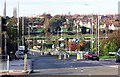
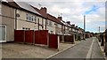
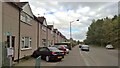
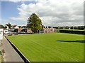
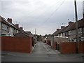
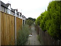
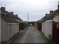
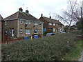
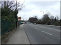
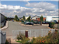
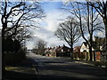
11 photos from this area
Area Information
Key information about the NG18 3HA including its size, population, and administrative classification.
- Area Type
- Postcode
- Area Size
- 1.4 hectares
- Population
- 1389
- Population Density
- 3228 people/km²
House Prices in NG18 3HA
39
Properties
£119,890
Average Sold Price
£30,000
Lowest Price
£248,750
Highest Price
Showing 39 properties
| Address | Type | Beds | Baths | Last Sale Price | Last Sale Date | |
|---|---|---|---|---|---|---|
| 19 Carisbrook Avenue, Mansfield, NG18 3HA | Semi-detached | 3 | 1 | £160,000 | Nov 2022 | |
| 16 Carisbrook Avenue, Mansfield, NG18 3HA | house | 3 | - | £214,000 | Aug 2022 | |
| 12 Carisbrook Avenue, Mansfield, NG18 3HA | Semi-detached | 5 | 1 | £248,750 | Jul 2022 | |
| 23 Carisbrook Avenue, Mansfield, NG18 3HA | Semi-detached | 3 | 1 | £175,000 | Aug 2021 | |
| 9 Carisbrook Avenue, Mansfield, NG18 3HA | house | - | - | £165,000 | Dec 2020 | |
| 7 Carisbrook Avenue, Mansfield, NG18 3HA | Semi-detached | 3 | 1 | £150,000 | Sep 2019 | |
| 21 Carisbrook Avenue, Mansfield, NG18 3HA | house | - | - | £171,000 | Aug 2019 | |
| 24 Carisbrook Avenue, Mansfield, NG18 3HA | Semi-detached | 3 | 1 | £130,000 | Jan 2017 | |
| 6 Carisbrook Avenue, Mansfield, NG18 3HA | Semi-detached | 3 | - | £117,000 | Dec 2016 | |
| 35 Carisbrook Avenue, Mansfield, NG18 3HA | house | - | - | £110,000 | Sep 2016 |
Page 1 of 4
Energy Efficiency in NG18 3HA
Amenities
Schools
| Rank | School | Type | Entry gender | Ages |
|---|
Explore more schools in this area
Go to Schools tabDemographics
Household Size
Two person
most common
Accommodation Type
Houses
most common
Tenure
90
majority
Ethnic Group
White
most common
Religion
N/A
most common
Household Composition
N/A
most common
Age
47
median
Adults (30-64 years)
most common
Household Deprivation
N/A
with no deprivation
NS-SEC
26
in Lower managerial occupations
Explore more demographic insights in this area
Go to Demographics tabPlanning
Planning Constraints
- Flood RiskPremium
- Ramsar Wetland SitesPremium
- Area of Outstanding Natural BeautyPremium
- Protected Nature ReservePremium
- Protected WoodlandPremium