Area Overview for NG18 2RL
Photos of NG18 2RL
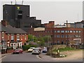

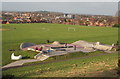

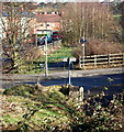
43 photos from this area
Area Information
Key information about the NG18 2RL including its size, population, and administrative classification.
- Area Type
- Postcode
- Area Size
- 2.5 hectares
- Population
- 1749
- Population Density
- 4408 people/km²
House Prices in NG18 2RL
17
Properties
-
Average Sold Price
-
Lowest Price
-
Highest Price
Showing 17 properties
| Address | Type | Beds | Baths | Last Sale Price | Last Sale Date | |
|---|---|---|---|---|---|---|
| Unit 10, The Broadway, Mansfield, NG18 2RL | Flat | - | - | - | - | |
| Jewson Limited, Unit 15, The Broadway, Mansfield, NG18 2RL | warehouse | - | - | - | - | |
| Arrowdale Building Services Limited, Unit 5, The Broadway, Mansfield, NG18 2RL | storage_distribution | - | - | - | - | |
| Alma Engineering, Unit 8, The Broadway, Mansfield, NG18 2RL | Industrial | - | - | - | - | |
| Mer Electrical And Mechanical Engineers Ltd, Unit 6, The Broadway, Mansfield, NG18 2RL | Industrial | - | - | - | - | |
| B & R Motor Traders, Unit 1, The Broadway, Mansfield, NG18 2RL | Office | - | - | - | - | |
| Centrefield Serviced Offices, Centrefield, The Broadway, Mansfield, NG18 2RL | Office | - | - | - | - | |
| J K D Builders Limited, Unit 2B, The Broadway, Mansfield, NG18 2RL | Industrial | - | - | - | - | |
| Rumor Apparel, Edis House, The Broadway, Mansfield, NG18 2RL | office_workshop | - | - | - | - | |
| Arrowdale Building Services Limited, Heatcare, The Broadway, Mansfield, NG18 2RL | storage_distribution | - | - | - | - |
Page 1 of 2
Energy Efficiency in NG18 2RL
Amenities
Schools
| Rank | School | Type | Entry gender | Ages |
|---|
Explore more schools in this area
Go to Schools tabDemographics
Household Size
One person
most common
Accommodation Type
Houses
most common
Tenure
41
majority
Ethnic Group
White
most common
Religion
N/A
most common
Household Composition
N/A
most common
Age
47
median
Adults (30-64 years)
most common
Household Deprivation
N/A
with no deprivation
NS-SEC
18
in Lower managerial occupations
Explore more demographic insights in this area
Go to Demographics tabPlanning
Planning Constraints
- Flood RiskPremium
- Ramsar Wetland SitesPremium
- Area of Outstanding Natural BeautyPremium
- Protected Nature ReservePremium
- Protected WoodlandPremium