Area Overview for NG18 2BG
Photos of NG18 2BG
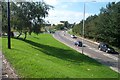
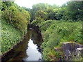
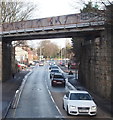
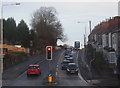
18 photos from this area
Area Information
Key information about the NG18 2BG including its size, population, and administrative classification.
- Area Type
- Postcode
- Area Size
- 1.2 hectares
- Population
- 1496
- Population Density
- 2357 people/km²
House Prices in NG18 2BG
59
Properties
£69,870
Average Sold Price
£14,200
Lowest Price
£132,500
Highest Price
Showing 59 properties
| Address | Type | Beds | Baths | Last Sale Price | Last Sale Date | |
|---|---|---|---|---|---|---|
| 11 Carlton Street, Mansfield, NG18 2BG | Terraced | 2 | 1 | £100,000 | Mar 2025 | |
| 58 Carlton Street, Mansfield, NG18 2BG | Terraced | 2 | 1 | £71,000 | Jul 2024 | |
| 44 Carlton Street, Mansfield, NG18 2BG | Terraced | 2 | 1 | £75,000 | May 2024 | |
| 22 Carlton Street, Mansfield, NG18 2BG | Terraced | 2 | 1 | £122,000 | Aug 2023 | |
| 36 Carlton Street, Mansfield, NG18 2BG | Terraced | 2 | 1 | £88,000 | Aug 2023 | |
| 29 Carlton Street, Mansfield, NG18 2BG | Terraced | 2 | 1 | £94,500 | Aug 2023 | |
| 30 Carlton Street, Mansfield, NG18 2BG | Semi-detached | 2 | 1 | £85,000 | Aug 2022 | |
| 68 Carlton Street, Mansfield, NG18 2BG | Terraced | 2 | 1 | £109,000 | Apr 2022 | |
| 49 Carlton Street, Mansfield, NG18 2BG | Terraced | 2 | 1 | £88,500 | Oct 2021 | |
| 74 Carlton Street, Mansfield, NG18 2BG | Detached | 2 | 1 | £120,000 | Feb 2021 |
Page 1 of 6
Energy Efficiency in NG18 2BG
Amenities
Schools
| Rank | School | Type | Entry gender | Ages |
|---|
Explore more schools in this area
Go to Schools tabDemographics
Household Size
One person
most common
Accommodation Type
Houses
most common
Tenure
47
majority
Ethnic Group
White
most common
Religion
N/A
most common
Household Composition
N/A
most common
Age
47
median
Adults (30-64 years)
most common
Household Deprivation
N/A
with no deprivation
NS-SEC
25
in Lower managerial occupations
Explore more demographic insights in this area
Go to Demographics tabPlanning
Planning Constraints
- Flood RiskPremium
- Ramsar Wetland SitesPremium
- Area of Outstanding Natural BeautyPremium
- Protected Nature ReservePremium
- Protected WoodlandPremium