Area Overview for NG18 1ED
Photos of NG18 1ED

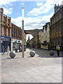
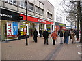
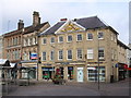
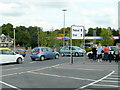
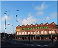
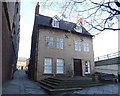
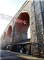

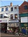

Area Information
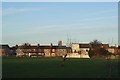
NG18 1ED is a specific postcode area covering a small residential cluster in Mansfield. This tight-knit cluster has a population of 1,838 residents, creating an intimate setting where neighbours are likely to know one another. You are not living in a vast metropolis here, but rather in a defined pocket of the wider borough. The demographic profile of this area skews towards adults aged between 30 and 64 years, with a median age of 47. This age range suggests a community comprised largely of established households, families with grown children, or retired professionals. Daily life revolves around practical convenience rather than high-energy urban nightlife. Residents benefit from a quiet environment defined by its housing type. The area contains predominantly houses, offering typical suburban living arrangements. You might find these homes situated close to rural кольца or established parkland, characteristic of the Mansfield region. The low population density means less foot traffic on local streets compared to the town centre. Living in NG18 1ED provides a respite from urban congestion while maintaining access to broader regional networks. The proximity to Mansfield Woodhouse and Sutton Parkway ensures you remain connected to wider employment and leisure destinations without the chaos often associated with major transport hubs. This balance makes the postcode a suitable choice for those prioritising tranquility over city centre proximity.
- Area Type
- Postcode
- Area Size
- Not available
- Population
- 1838
- Population Density
- 2889 people/km²
The property market in NG18 1ED is defined by its housing stock and ownership patterns. Since the area comprises only houses, you will encounter detached, semi-detached, or terraced properties typical of the suburb. There are no flats or apartments to consider when searching for homes in this specific postcode. The 43% home ownership rate indicates a significant portion of the population owns their dwelling, suggesting a market with many established sellers. This figure is lower than the national UK average, which often points to a slightly higher volume of rental housing within this small cluster. When viewing properties, expect to see standard suburban designs that have suited families for decades. The accommodation type data confirms a lack of vertical living, so every residence offers ground-level access or private gardens. Buyers looking at homes in NG18 1ED can rest assured that they are purchasing land and structure rather than a block of flats. The lower home ownership statistic might mean more rental inventory is available, which can be advantageous for investors or those unable to secure a mortgage. However, the primary stock remains owner-occupied family homes. This market structure prioritises stability over rapid turnover. You should focus your search on listings that match your preferred garden size or room layout, as the variety will be limited to traditional house styles.
House Prices in NG18 1ED
No properties found in this postcode.
Energy Efficiency in NG18 1ED
Residents of NG18 1ED benefit from practical amenities located within practical reach. Retail options include Heron Mansfield, M&S Mansfield, and Iceland Mansfield, providing essentials for daily shopping. You can find clothing, groceries, and household goods without needing to travel long distances into the city centre. Five retail venues in total serve the local community, ensuring baseline convenience. For train commuters, the area has excellent rail access via Mansfield Railway Station, Mansfield Woodhouse Railway Station, and Sutton Parkway Railway Station. These five railway locations are within a short distance, facilitating easy trips to Nottingham or other regional hubs. Leisure opportunities are supported by these transport links rather than local parks or cinemas being immediately adjacent. The character of the area is utilitarian, focusing on getting you to merchants and stations efficiently. If you value a quick stop for groceries after school or before bed, the M&S and Iceland stores address that need. The presence of multiple railway stations means you have choices regarding departure times and ticket prices. Living in this environment means a lifestyle ordered around scheduled trains and local high street needs rather than spontaneous local entertainment. You will find what you need in the town centre nearby, but the small residential cluster itself is quiet and focused on residence.
Amenities
Schools
Families living in NG18 1ED have access to several educational institutions nearby. St Philip Neri with St Bede Catholic Primary School serves the younger children in the catchment. St John's CofE Middle School operates as another primary option for local youngsters. Overseas visitors or families seeking independence might consider West Bridgford High School, which functions as an independent school. Queen Elizabeth's Girls' School also provides primary education within the immediate vicinity. For those requiring secondary education, Vision Studio School is located near the area. The mix of schools includes both Catholic and Church of England faith-based primary institutions alongside an independent option and a special needs secondary provision. This variety allows parents to choose based on educational philosophy or specific learning requirements without travelling far. You can check the Ofsted ratings for St Philip Neri, St John's, and Queen Elizabeth's if school performance is a priority. Although West Bridgford High School is independent, it offers an alternative curriculum track to state-funded primaries. Vision Studio School caters to specific secondary needs, indicating some specialist educational resources are close by. The presence of multiple primary options means you have flexibility regarding catchment boundaries. When planning your move, verify which primary school matches your child's needs before committing to a new home in NG18 1ED.
| Rank | School | Type | Entry gender | Ages |
|---|
Explore more schools in this area
Go to Schools tabDemographics
The community in NG18 1ED displays clear demographic characteristics shaped by its residential nature. The median age of 47 years indicates a mature population, with most residents falling into the 30-to-64 years bracket. This concentration of adults suggests a stable community where long-term residents have likely put down roots. Home ownership stands at 43%, which means slightly less than half of the households own their properties outright or with a mortgage. Consequently, the remaining households reside in rental accommodations, adding a layer of diversity to the local tenancy landscape. Ethnically, the predominant group in this postcode is White, reflecting the broader makeup of the East Midlands. The housing stock is exclusively composed of houses, meaning you will not find flats or apartments within this specific cluster. This single accommodation type reinforces the suburban character of the neighbourhood. While 43% of residents are owners, you may notice transient populations among those renting. The age data confirms that young families with very small children or empty nesters might be less common than households with older children or service professionals in mid-career. The demographic stability contributes to a predictable neighbourhood dynamic where changes in population turnover are relatively slow.
Household Size
Accommodation Type
Tenure
Ethnic Group
Religion
Household Composition
Age
Household Deprivation
NS-SEC
Explore more demographic insights in this area
Go to Demographics tabPlanning
Planning Constraints
- Flood RiskPremium
- Ramsar Wetland SitesPremium
- Area of Outstanding Natural BeautyPremium
- Protected Nature ReservePremium
- Protected WoodlandPremium