Area Overview for NG17 9BA
Photos of NG17 9BA

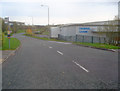
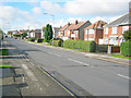
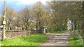
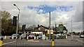


31 photos from this area
Area Information
Key information about the NG17 9BA including its size, population, and administrative classification.
- Area Type
- Postcode
- Area Size
- 2.4 hectares
- Population
- 2406
- Population Density
- 2079 people/km²
House Prices in NG17 9BA
30
Properties
£122,821
Average Sold Price
£1,000
Lowest Price
£230,000
Highest Price
Showing 30 properties
| Address | Type | Beds | Baths | Last Sale Price | Last Sale Date | |
|---|---|---|---|---|---|---|
| 23 Robin Hood Road, Kirkby In Ashfield, NG17 9BA | Semi-detached | 3 | 2 | £230,000 | Feb 2024 | |
| 24 Robin Hood Road, Kirkby In Ashfield, NG17 9BA | Semi-detached | 3 | 1 | £196,000 | Apr 2023 | |
| 11 Robin Hood Road, Kirkby In Ashfield, NG17 9BA | Bungalow | - | - | £220,000 | Apr 2023 | |
| 13 Robin Hood Road, Kirkby In Ashfield, NG17 9BA | Detached | 3 | 1 | £195,000 | Aug 2019 | |
| 28 Robin Hood Road, Kirkby In Ashfield, NG17 9BA | Semi-detached | 3 | 1 | £133,000 | Oct 2017 | |
| 25 Robin Hood Road, Kirkby In Ashfield, NG17 9BA | Semi-detached | - | - | £1,000 | Aug 2016 | |
| 18 Robin Hood Road, Kirkby In Ashfield, NG17 9BA | Semi-detached | 3 | 1 | £114,000 | Mar 2016 | |
| 22 Robin Hood Road, Kirkby In Ashfield, NG17 9BA | Semi-detached | 3 | 1 | £81,000 | Sep 2015 | |
| 3 Robin Hood Road, Kirkby In Ashfield, NG17 9BA | Bungalow | 2 | - | £120,000 | Feb 2015 | |
| 9 Robin Hood Road, Kirkby In Ashfield, NG17 9BA | Bungalow | - | - | £120,000 | Sep 2010 |
Page 1 of 3
Energy Efficiency in NG17 9BA
Amenities
Schools
| Rank | School | Type | Entry gender | Ages |
|---|
Explore more schools in this area
Go to Schools tabDemographics
Household Size
Two person
most common
Accommodation Type
Houses
most common
Tenure
87
majority
Ethnic Group
White
most common
Religion
N/A
most common
Household Composition
N/A
most common
Age
47
median
Adults (30-64 years)
most common
Household Deprivation
N/A
with no deprivation
NS-SEC
32
in Lower managerial occupations
Explore more demographic insights in this area
Go to Demographics tabPlanning
Planning Constraints
- Flood RiskPremium
- Ramsar Wetland SitesPremium
- Area of Outstanding Natural BeautyPremium
- Protected Nature ReservePremium
- Protected WoodlandPremium